

| Mesoscale Discussion 1671 | |
| < Previous MD | |

|
|
   Mesoscale Discussion 1671
   NWS Storm Prediction Center Norman OK
   0837 AM CDT Mon Jul 20 2026

   Areas affected...Western Upper Peninsula of Michigan and adjacent
   Wisconsin

   Concerning...Severe potential...Watch unlikely

   Valid 201337Z - 201530Z

   Probability of Watch Issuance...20 percent

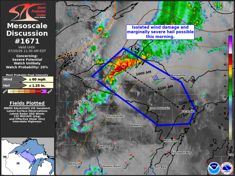
   SUMMARY...Isolated damaging winds and marginally severe hail are
   possible this morning. A gradual weakening trend is anticipated and
   a watch is not expected. Trends will continue to be monitored.

   DISCUSSION...A small elevated linear segment has moved into the
   western Upper Peninsula of Michigan. The observed soundings from INL
   and APX this morning show around 7 C/km mid-level lapse rates. This
   activity is currently being driven by moderate low-level warm
   advection. With time, however, the low-level jet will weaken and
   veer. Elevated buoyancy will be able to sustain robust convection
   for another hour or two as it moves southeastward at around 35 kt.
   The overall expectation is for this linear segment to outpace
   favorable buoyancy before low-level moistening increases later
   today. Isolated damaging winds will be the main threat this morning,
   though steep mid-level lapse rates could support marginally severe
   hail as well.

   ..Wendt/Thompson.. 07/20/2026

   ...Please see www.spc.noaa.gov for graphic product...

   ATTN...WFO...MQT...GRB...

   LAT...LON   46548988 47188889 46428704 45818661 45508680 45478777
               46548988

   MOST PROBABLE PEAK WIND GUST...UP TO 60 MPH
   MOST PROBABLE PEAK HAIL SIZE...UP TO 1.25 IN
|
|
|
Top/All Mesoscale Discussions/Forecast Products/Home |
|
Source link