| Mesoscale Discussion 1662 | |
| < Previous MD | |

|
|
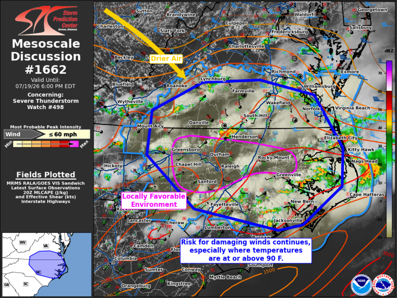
Mesoscale Discussion 1662 NWS Storm Prediction Center Norman OK 0331 PM CDT Sun Jul 19 2026 Areas affected...Southern Mid-Atlantic into North Carolina Concerning...Severe Thunderstorm Watch 498... Valid 192031Z - 192200Z The severe weather threat for Severe Thunderstorm Watch 498 continues. SUMMARY...A risk for damaging winds will continue into early evening. The greatest risk will be in areas where temperatures are 90+ F. DISCUSSION...Scattered convection within southern Virginia and central/eastern North Carolina has led to considerable convective overturning. Within a corridor from Greensboro to Greenville, temperatures remain in the low/mid 90s F. Visible satellite shows towering cumulus increasing in parts of this zone as well. This region will likely see the greatest potential for strong/damaging winds given the locally steeper low-level lapse rates. Otherwise, the cold front continues to sag southward this afternoon into southern Virginia. Dewpoints are falling rapidly as this occurs. The severe risk should gradually decrease from northwest to southeast as this trends continues into the evening. ..Wendt.. 07/19/2026 ...Please see www.spc.noaa.gov for graphic product... ATTN...WFO...AKQ...MHX...RAH...ILM...RNK... LAT...LON 35037923 36038033 36878024 37417906 37467771 37177644 36167579 35437582 34727674 34627729 35037923 MOST PROBABLE PEAK WIND GUST...UP TO 60 MPH |
|
|
Top/All Mesoscale Discussions/Forecast Products/Home |
|
Source link