

| Mesoscale Discussion 1652 | |
| < Previous MD | |

|
|
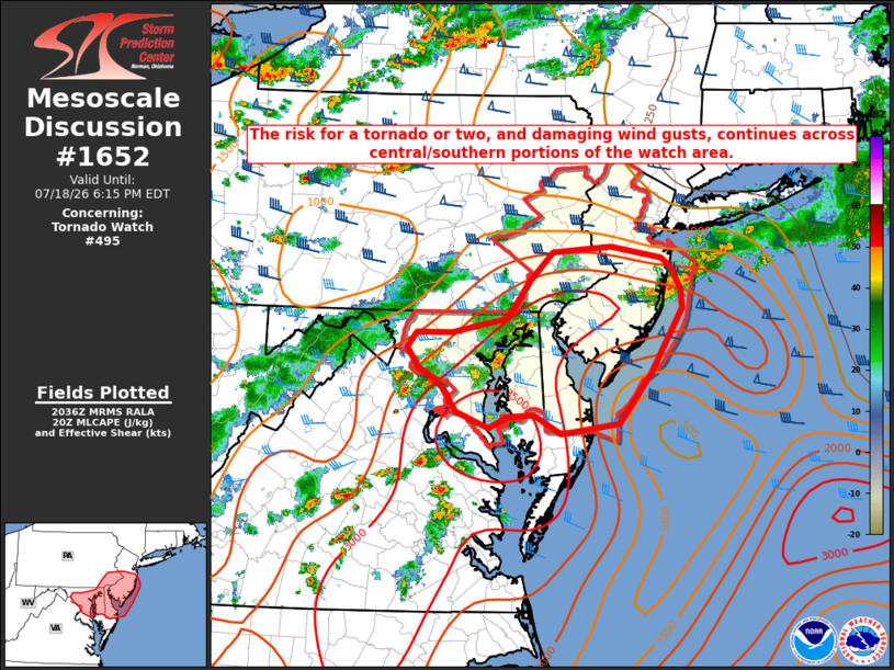
Mesoscale Discussion 1652 NWS Storm Prediction Center Norman OK 0339 PM CDT Sat Jul 18 2026 Areas affected...portions of eastern Pennsylvania...central and southern New Jersey...eastern Maryland...Delaware Concerning...Tornado Watch 495... Valid 182039Z - 182215Z The severe weather threat for Tornado Watch 495 continues. SUMMARY...Severe thunderstorms will continue across the watch area and pose a risk for a couple tornadoes and damaging wind gusts. DISCUSSION...A composite warm front, reinforced by convective outflow, extends from central NJ into east-central PA at 2025z. Thunderstorms north of this boundary will likely slow any northward progress over the next few hours, with the greatest supercell potential along and south of the warm front across eastern MD, Delaware, and southern/central NJ. Enhanced low-level shear in the vicinity of the warm front remains supportive of low-level rotation and attendant tornado risk with any more discrete/persistent storm. Strong instability/steep low-level lapse rates across the southern portion of the watch will contribute to the continued potential for damaging winds, especially as storms merge/evolve into clusters. Some tornado risk will exist as storm interactions occur given the magnitude of instability. ..Bunting.. 07/18/2026 ...Please see www.spc.noaa.gov for graphic product... ATTN...WFO...PHI...AKQ...CTP...LWX... LAT...LON 40037590 40347559 40407480 40297410 40187398 39967384 39757383 39077426 38537468 38427548 38627584 38617619 38487646 38657689 38987713 39117740 39347757 39507743 39507696 39657621 40037590 |
|
|
Top/All Mesoscale Discussions/Forecast Products/Home |
|
Source link