

| Mesoscale Discussion 1600 | |
| < Previous MD Next MD > | |

|
|
   Mesoscale Discussion 1600
   NWS Storm Prediction Center Norman OK
   1212 PM CDT Sun Jul 12 2026

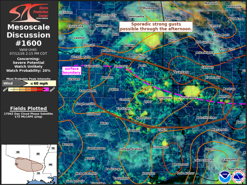
   Areas affected...northeast TX vicinity into northern LA

   Concerning...Severe potential...Watch unlikely

   Valid 121712Z - 121915Z

   Probability of Watch Issuance...20 percent

   SUMMARY...Scattered to numerous thunderstorms are expected through
   the afternoon. Sporadic strong gusts are possible, though severe
   potential is expected to remain limited.

   DISCUSSION...A very moist airmass characterized by 70s F dewpoints
   is in place across the ArkLaTex vicinity this afternoon. Strong
   heating of this very moist airmass along a west to east oriented
   surface boundary is supporting moderate instability as of midday.
   Thunderstorms are already developing along this boundary, and on the
   southern periphery of a convectively enhanced vorticity maxima.
   Vertical shear will remain weak today, limiting a more organized
   severe risk. However, steepening low-level lapse rates through the
   afternoon in conjunction with water laden downdrafts, could support
   sporadic wet microbursts, with a few stronger gusts possible. A
   severe thunderstorm watch appears unlikely at this time.

   ..Leitman/Smith.. 07/12/2026

   ...Please see www.spc.noaa.gov for graphic product...

   ATTN...WFO...JAN...SHV...TSA...HGX...FWD...OUN...

   LAT...LON   34149707 33849510 33149259 32639155 32239147 31769188
               31489324 31489507 31929657 32309732 32919764 33569765
               33869761 34149707

   MOST PROBABLE PEAK WIND GUST...UP TO 60 MPH
|
|
|
Top/All Mesoscale Discussions/Forecast Products/Home |
|
Source link