| Mesoscale Discussion 1599 | |
| < Previous MD Next MD > | |

|
|
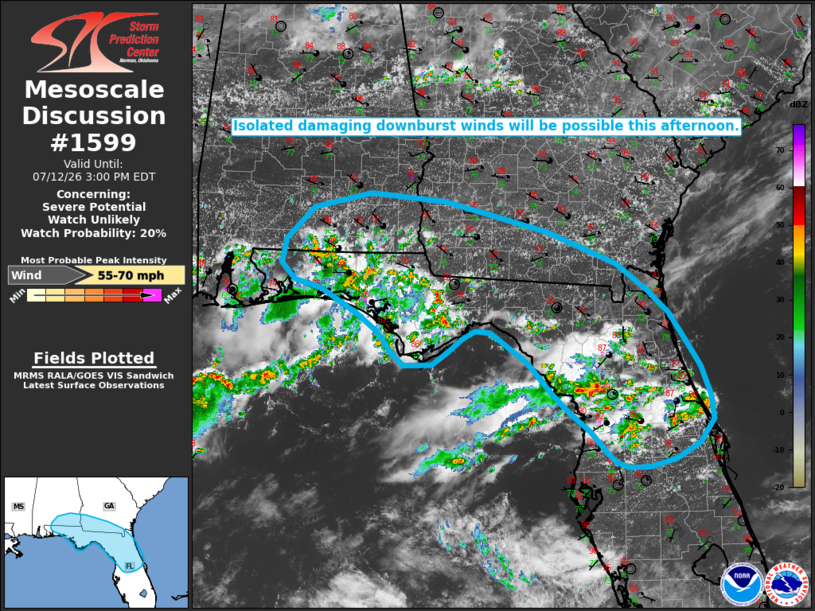
   Mesoscale Discussion 1599
   NWS Storm Prediction Center Norman OK
   1200 PM CDT Sun Jul 12 2026

   Areas affected...portions of North Florida and the Florida Panhandle
   into southwestern Georgia and southeastern Alabama

   Concerning...Severe potential...Watch unlikely

   Valid 121700Z - 121900Z

   Probability of Watch Issuance...20 percent

   SUMMARY...Isolated damaging wind gusts and perhaps an instance or
   two of small hail will be possible over the next several hours.

   DISCUSSION...Scattered thunderstorms have developed along the Gulf
   Coast sea breeze from the Florida Panhandle into North Florida amid
   a hot and humid air mass, with a couple of gusts measured in the
   40-45 mph range over the past 1-2 hours. Temperatures near 90 F and
   dewpoints in the low/mid 70s are already supporting 2000-3000 J/kg
   MLCAPE, with further destabilization expected through peak heating
   this afternoon. Coupled with high PW (greater than 2 inches) and
   steepening low-level lapse rates, an isolated risk for water-loaded
   downbursts, damaging wind gusts (with localized gusts to 65 mph
   possible), and perhaps an instance or two of small hail should
   materialize across the region. Weak effective shear and deep
   layer-flow will temper overall convective intensity and
   organization. Thus, watch issuance appears unlikely at this time.

   ..Chalmers/Smith.. 07/12/2026

   ...Please see www.spc.noaa.gov for graphic product...

   ATTN...WFO...MLB...TBW...JAX...TAE...BMX...MOB...

   LAT...LON   30528654 30638694 30848714 31148709 31568668 31778581
               31678470 31288317 30858213 30528168 30228136 29838111
               29518091 29118076 28828072 28528094 28338128 28228167
               28228197 28298217 28428230 28698254 28918284 29198312
               29588346 29968402 29998425 29878444 29718466 29558488
               29548531 29708548 29968570 30208601 30528654

   MOST PROBABLE PEAK WIND GUST...55-70 MPH
|
|
|
Top/All Mesoscale Discussions/Forecast Products/Home |
|
Source link