

| Mesoscale Discussion 1575 | |
| < Previous MD | |

|
|
   Mesoscale Discussion 1575
   NWS Storm Prediction Center Norman OK
   0232 PM CDT Fri Jul 10 2026

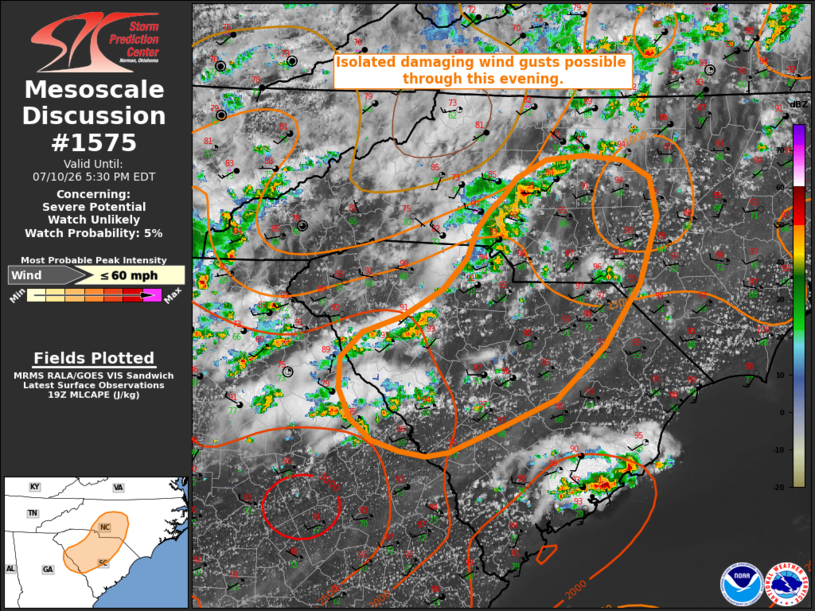
   Areas affected...portions of the central Carolinas and far eastern
   Georgia

   Concerning...Severe potential...Watch unlikely

   Valid 101932Z - 102130Z

   Probability of Watch Issuance...5 percent

   SUMMARY...Widely scattered convection will progress eastward across
   the Carolina Piedmont this afternoon, bringing a risk for isolated
   damaging wind gusts.

   DISCUSSION...Widely scattered convection has developed amid a hot
   and humid air mass (temperatures in the upper 90s and dewpoints in
   the mid-60s to near 70 F) in place across the Southeast, with a
   couple of reports of thunderstorm wind damage noted over the past
   hour. Two areas of greater convective coverage are noted via recent
   radar imagery: one in the vicinity of Charlotte, NC, and the other
   in western SC. Weak effective shear and deep-layer flow (generally
   25 kts or less sampled through the column by the CAE VWP) will limit
   convective organization and severity, but steep low-level lapse
   rates (8.5-9.0 C/km) and high PW (1.75+ inches) will facilitate a
   risk for isolated damaging wind gusts as this convection progresses
   eastward through this evening. A locally greater risk for damaging
   wind gusts will likely manifest with any more marginally organized
   clusters that can develop/persist. Given the limited potential for
   storm organization and the expectation for the severe magnitude to
   remain limited, watch issuance is not expected.

   ..Chalmers/Smith.. 07/10/2026

   ...Please see www.spc.noaa.gov for graphic product...

   ATTN...WFO...RAH...ILM...CAE...GSP...FFC...

   LAT...LON   35618090 35798074 35968040 35997997 35947951 35797922
               35427914 34807935 34217975 33718029 33478089 33228150
               33178177 33228207 33338237 33538261 33808275 34098273
               34338248 34488204 34748157 35028132 35318119 35478105
               35618090

   MOST PROBABLE PEAK WIND GUST...UP TO 60 MPH
|
|
|
Top/All Mesoscale Discussions/Forecast Products/Home |
|
Source link