| Mesoscale Discussion 1557 | |
| < Previous MD | |

|
|
Mesoscale Discussion 1557
NWS Storm Prediction Center Norman OK
0215 PM CDT Thu Jul 09 2026
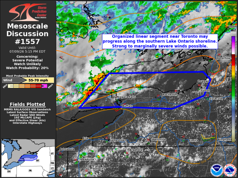
Areas affected...Portions of western New York
Concerning...Severe potential...Watch unlikely
Valid 091915Z - 092115Z
Probability of Watch Issuance...20 percent
SUMMARY...Strong to marginally severe wind gusts are possible along
and near the southern Lake Ontario shoreline. A watch is not
expected given the limited spatial extent of the threat.
DISCUSSION...A organized linear segment is ongoing near Toronto
driven by ascent from a shortwave trough. While the airmass near the
Lake Ontario shore is slightly cooler than surrounding areas, the
organization of the linear segment will likely allow it to propagate
some distance along the shoreline with aid from the lake breeze
boundary. The spatial extent of the threat is not expected to reach
farther inland than a county or two. Strong to marginally severe
wind gusts, particularly along the more exposed lake shore, are
possible.
..Wendt/Hart.. 07/09/2026
...Please see www.spc.noaa.gov for graphic product...
ATTN...WFO...BGM...BUF...
LAT...LON 42877729 42907891 42878019 43677928 43707631 43527607
43167630 42877729
MOST PROBABLE PEAK WIND GUST...55-70 MPH
|
|
|
Top/All Mesoscale Discussions/Forecast Products/Home |
|
Source link