| Mesoscale Discussion 1470 | |
| < Previous MD | |

|
|
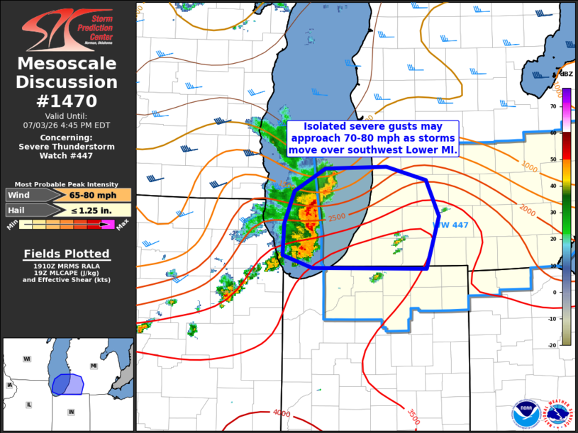
Mesoscale Discussion 1470 NWS Storm Prediction Center Norman OK 0213 PM CDT Fri Jul 03 2026 Areas affected...southwest Lower MI Concerning...Severe Thunderstorm Watch 447... Valid 031913Z - 032045Z The severe weather threat for Severe Thunderstorm Watch 447 continues. SUMMARY...A severe band of storms over Lake Michigan will move eastward into southwest Lower Michigan over the next hour. The strongest wind gusts may approach 70-80 mph, and a swath of damaging gusts is possible. DISCUSSION...A small but strong bowing cluster of storms over Lake MI will continue to track east around 40 kt into southwest Lower MI over next hour or so. This activity produced several measured gusts in the 65-73 mph range near Chicago before moving over southern Lake MI. Since then, this area of convection has some some signs of increasing organization. The MKX VWP shows a band of 45-60 kt 3-6 km westerly flow in the wake of this convection, indicating some degree of organized rear-inflow. This should aid in continued organization and severe wind potential across southwest Lower MI in the short term. ..Leitman.. 07/03/2026 ...Please see www.spc.noaa.gov for graphic product... ATTN...WFO...IWX...GRR... LAT...LON 42848691 42868599 42708540 42308522 41728540 41748709 41878754 42238752 42598737 42848691 MOST PROBABLE PEAK WIND GUST...65-80 MPH MOST PROBABLE PEAK HAIL SIZE...UP TO 1.25 IN |
|
|
Top/All Mesoscale Discussions/Forecast Products/Home |
|
Source link