| Mesoscale Discussion 1286 | |
| < Previous MD | |

|
|
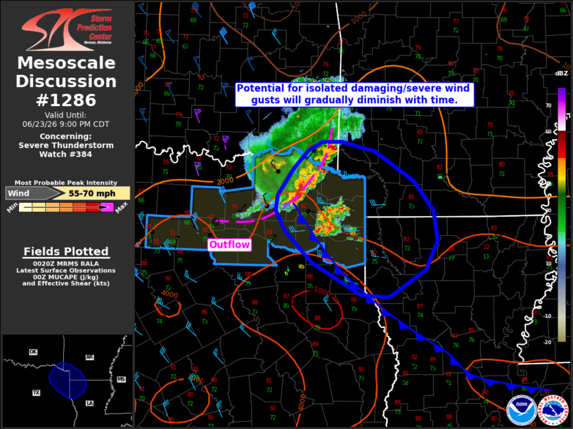
Mesoscale Discussion 1286 NWS Storm Prediction Center Norman OK 0723 PM CDT Tue Jun 23 2026 Areas affected...portions of the ArkLaTex Concerning...Severe Thunderstorm Watch 384... Valid 240023Z - 240200Z The severe weather threat for Severe Thunderstorm Watch 384 continues. SUMMARY...The severe risk will gradually diminish over the next couple of hours, but isolated damaging/severe wind gusts remain possible in the meantime. Downstream watch issuance is not anticipated. DISCUSSION...An organized convective cluster remains ongoing across the ArkLaTex downstream of a mid-level MCV as of 0020 UTC. MUCAPE of 2000-3000+ J/kg, modest effective shear of 20-30 kts, and continued cold pool forcing should allow this cluster to continue to progress east-southeastward over the next several hours along the cool side of a surface cold front currently analyzed from northeast Texas southeastward into southern Louisiana. Gradual nocturnal low-level cooling/stabilization will yield a diminishing severe risk with time as thunderstorms become elevated, but isolated damaging/severe wind gusts remain possible over the next 1-2 hours while thunderstorms remain surface based. Downstream watch issuance is not anticipated at this time, but trends will continue to be monitored. ..Chalmers/Smith.. 06/24/2026 ...Please see www.spc.noaa.gov for graphic product... ATTN...WFO...SHV...FWD... LAT...LON 31929366 31959411 32409489 32839534 33109548 33319545 33679520 33919495 34049472 34039441 33909387 33509325 33099294 32689287 32299306 31989357 31929366 MOST PROBABLE PEAK WIND GUST...55-70 MPH |
|
|
Top/All Mesoscale Discussions/Forecast Products/Home |
|
Source link