

In brief: Today we look at the increased development odds of Invest 91L, as well as the couple scenarios that are on the table. Interests along the Gulf Coast should monitor Invest 91L closely over the next couple days.
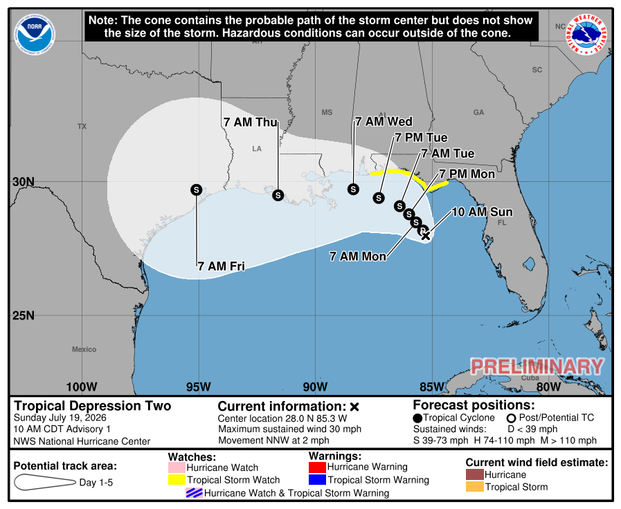
Editor’s Note: Invest 91L was reclassified as Tropical Depression 2 as our post was published.
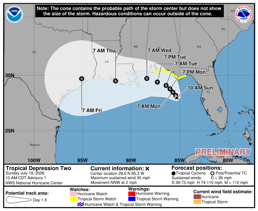
Let’s check out Invest 91L this morning.

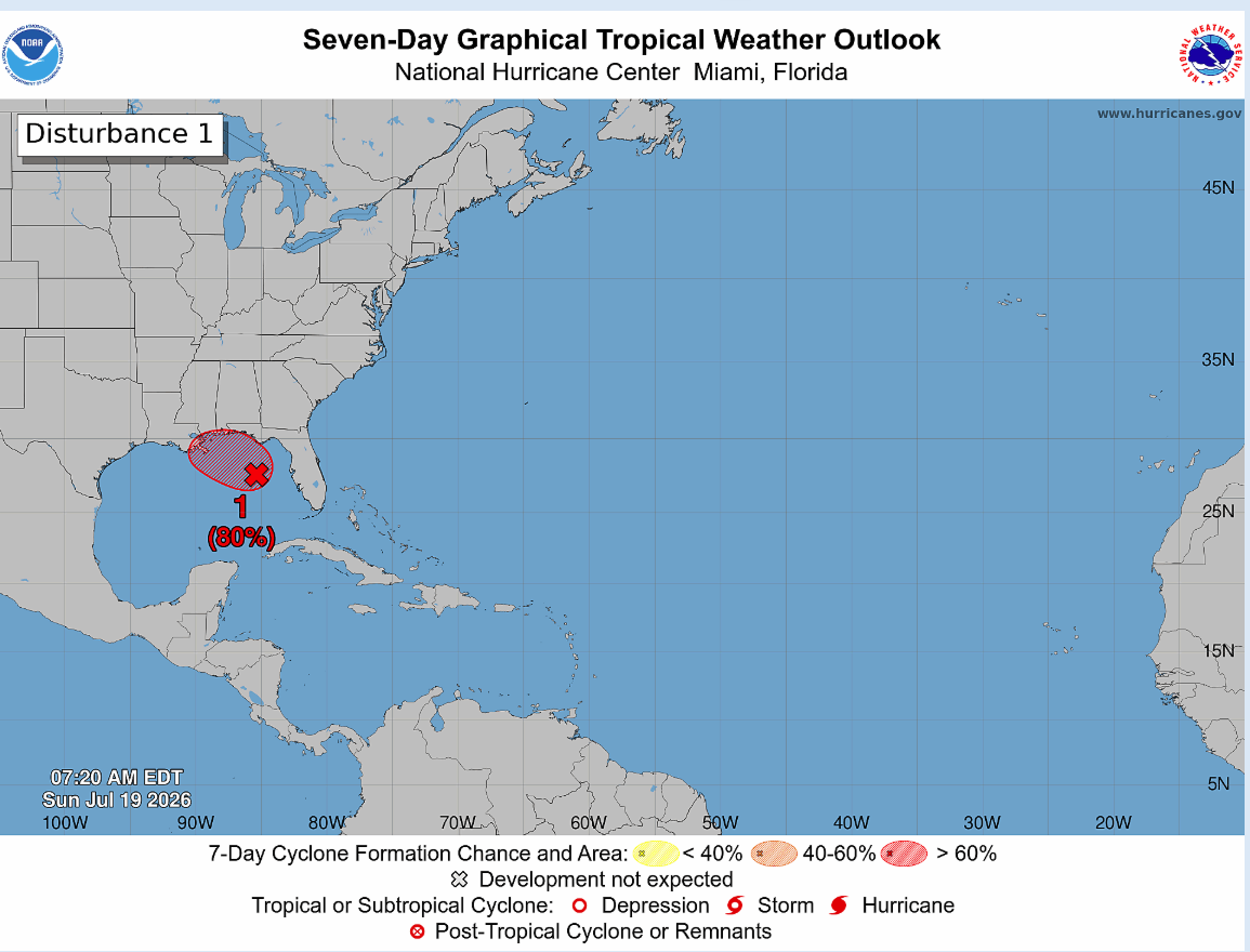
Not terrible. Still not a tropical system, but we’re slowly getting there. The NHC odds have increased to 80 percent this morning.
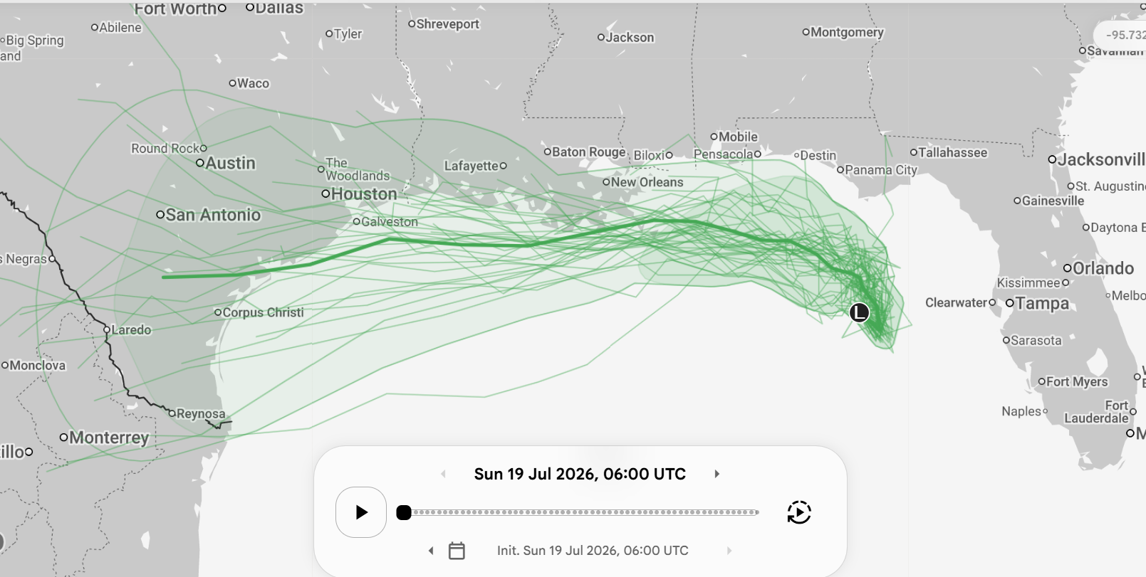
Modeling is getting a bit more aggressive with developing this into a formal entity. Of the 1,000 Google Deep Mind ensemble members, almost all 1,000 are now developing the system. Looking closer at the operational version of GDM, we can see a general track spread that either hugs or stays just south of the Gulf Coast.
When looking at the possible intensity of 91L, the vast majority of guidance, including about 75 percent of the 1,000 member ensemble keep this a tropical storm. Most tropical modeling aside from Google agrees on this as well.
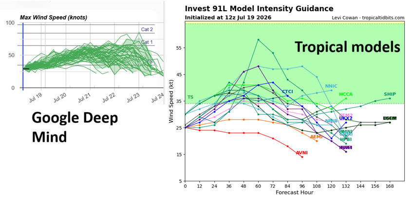
There are a couple GDM members that bring 91L up to hurricane intensity. And when you look at the European ensemble, we see this as well to a much more substantial extent.

It is worth noting that some changes were made to the European ensemble this past spring, so we’re kind of working with an unknown quantity, at least operationally right now. The AIFS ensemble is notably much, much weaker than the Euro physical. This feels like a bit too much of an outlier to me to take seriously right now, but obviously folks on the Texas and Louisiana coasts should keep watch on this.
In terms of the overall environment that Invest 91L, if you look at the operational European model (not the ensemble), you’ll see that generally, Invest 91L will be operating within a little cocoon of favorable moisture levels, but dry air is not far away, surrounding the cocoon on all sides.
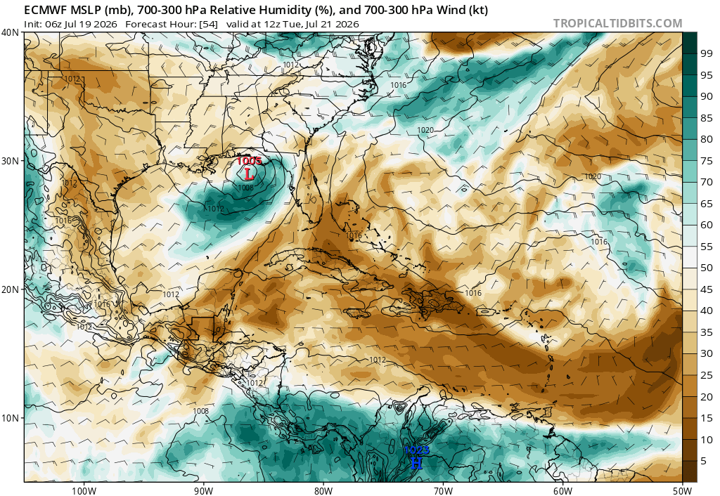
How about wind shear? Well, there’s going to be a good bit of northerly or northeasterly shear as well in the Gulf. That should help hold it back some. But it may also allow it to track a little farther offshore, increasing its residence time over warmer water, which could allow for a little bump in potential intensity. The upper pattern does in fact offer that as a possibility, with strong high pressure over northern Texas, it could allow a farther south and west track to occur.
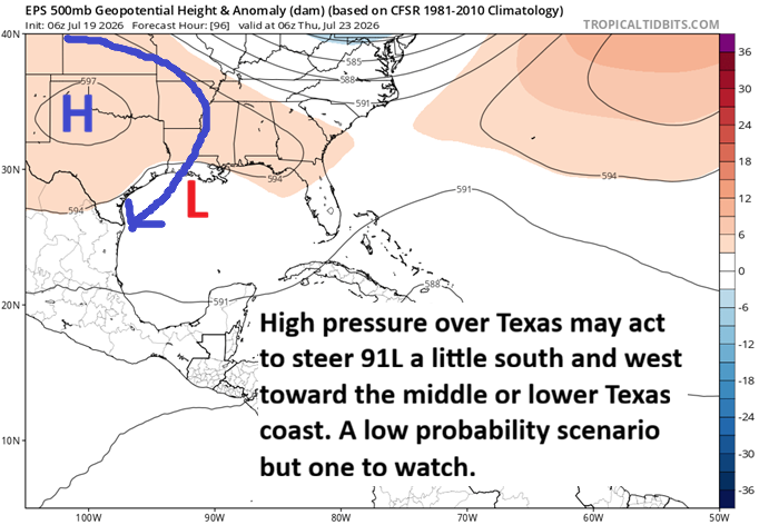
So what’s the story here? I think we can expect gradual development over the next 36 hours from Invest 91L, possibly becoming a “potential tropical cyclone” by later today or Monday morning. The smart money right now would be on a mid-grade tropical storm tracking into Louisiana. However, there is a not so inconsequential minority solution that takes Invest 91L farther south and west, opening the doors to more of a Texas coast outcome, most likely south of Houston.
Bottom line: Gulf interests should be monitoring this system over the next couple days. We may post an update as early as later today. Stay tuned.
Source link