

| Mesoscale Discussion 2065 | |
| < Previous MD | |
|
|
   Mesoscale Discussion 2065
   NWS Storm Prediction Center Norman OK
   0913 AM CDT Fri Aug 21 2026

   Areas affected...parts of central and eastern South Carolina and
   North Carolina

   Concerning...Severe potential...Watch possible

   Valid 211413Z - 211645Z

   Probability of Watch Issuance...40 percent

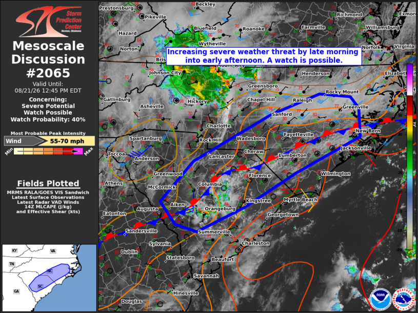
   SUMMARY...The threat for at least isolated damaging wind gusts is
   expected to increase by late morning into early afternoon.
   Convective trends are being monitored for a possible watch.

   DISCUSSION...Widely scattered showers and thunderstorms are ongoing
   as of 14Z from south through east of Columbia, SC with additional
   agitated cumulus observed along a quasi-stationary boundary
   extending into eastern NC. The 12z MHX and CHS soundings sampled a
   very moist air mass, characterized by boundary-layer dewpoints in
   the mid to upper 70s and precipitable water values of 2.1-2.2
   inches, which are contributing to moderate to strong instability
   when modified for current surface conditions.

   While forcing for ascent attendant to an MCV currently located over
   far western NC is expected to remain to the north of the region, the
   presence of the surface front and negligible capping in the observed
   soundings should allow for a gradual increase in storm coverage and
   intensity through the remainder of the morning into early afternoon.
   Vertical shear is expected to remain weak, which will limit the
   organization and longevity of individual storms. Nonetheless, degree
   of instability will support locally intense pulse-type storms with
   an associated risk for damaging wind gusts increasing by late
   morning into early afternoon.

   ..Mead/Smith.. 08/21/2026

   ...Please see www.spc.noaa.gov for graphic product...

   ATTN...WFO...MHX...RAH...ILM...CHS...CAE...GSP...

   LAT...LON   35067689 34307856 33607983 33088102 33238156 33708194
               34558112 35547918 35977792 35897712 35657692 35067689

   MOST PROBABLE PEAK WIND GUST...55-70 MPH
|
|
|
Top/All Mesoscale Discussions/Forecast Products/Home |
|
Source link