

| Mesoscale Discussion 1950 | |
| < Previous MD | |
|
|
   Mesoscale Discussion 1950
   NWS Storm Prediction Center Norman OK
   1132 AM CDT Wed Aug 12 2026

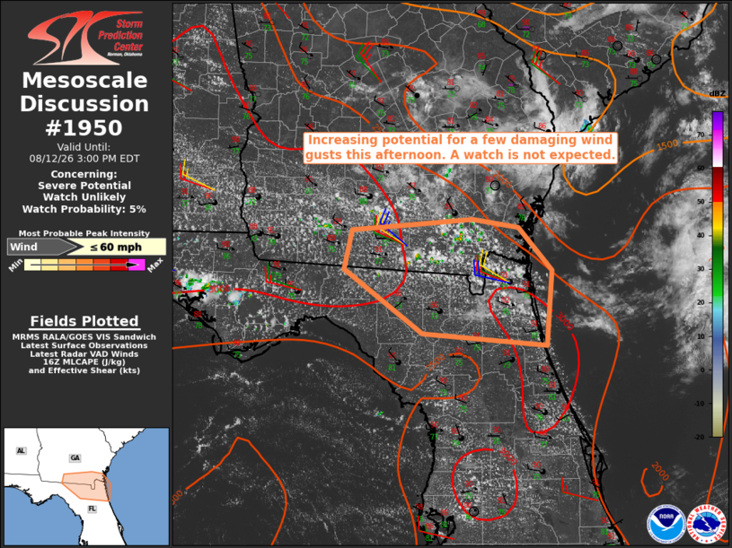
   Areas affected...southern Georgia into northeast Florida

   Concerning...Severe potential...Watch unlikely

   Valid 121632Z - 121900Z

   Probability of Watch Issuance...5 percent

   SUMMARY...The potential for a few damaging wind gusts is expected to
   increase this afternoon. A watch is not anticipated due to the
   limited areal coverage of the threat.

   DISCUSSION...Forcing for ascent within the southwest flank of an MCV
   moving through the lower Savannah River Valley will combine with
   broadly confluent low-level flow to yield scattered thunderstorms
   this afternoon. Area VWPs indicate relatively weak vertical shear
   across the region, which will limit the potential for storm
   organization. However, the 12Z JAX sounding sampled the presence of
   a very moist and strongly unstable air mass with MLCAPE of 3000-3500
   J/kg. As such, the potential will exist for locally intense wet
   microbursts capable of a few damaging wind gusts, especially if
   storms can merge into clusters.

   ..Mead/Thompson.. 08/12/2026

   ...Please see www.spc.noaa.gov for graphic product...

   ATTN...WFO...JAX...TAE...

   LAT...LON   29798124 29938279 30628378 31058369 31128294 31188217
               31098159 30628117 29798124

   MOST PROBABLE PEAK WIND GUST...UP TO 60 MPH
|
|
|
Top/All Mesoscale Discussions/Forecast Products/Home |
|
Source link