

| Mesoscale Discussion 1944 | |
| < Previous MD | |

|
|
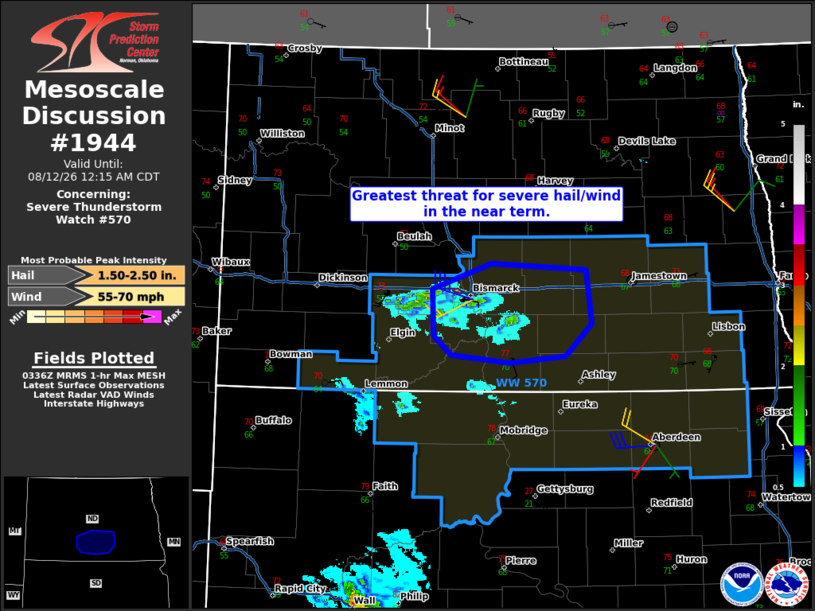
Mesoscale Discussion 1944 NWS Storm Prediction Center Norman OK 1038 PM CDT Tue Aug 11 2026 Areas affected...Parts of south-central ND Concerning...Severe Thunderstorm Watch 570... Valid 120338Z - 120515Z The severe weather threat for Severe Thunderstorm Watch 570 continues. SUMMARY...The greatest threat for severe hail/wind in the short term should focus across a small part of south-central North Dakota, including the Bismarck area. DISCUSSION...A cluster of supercells is ongoing as of 0330Z across south-central ND, aided by a weak mid-level disturbance moving southeastward across the northern Plains. Given favorable deep-layer shear and enhanced (40-50+ kt) westerly flow at 6+ km AGL shown on the latest VWP from KBIS, this activity will likely maintain organization in the near term. Severe hail and damaging winds may occur, with strong inbound velocities approaching the Bismarck area on latest radar imagery. Very large hail up to 2 inches in diameter has recently been reported with the strongest core. Longer-term prospects for these supercells remain uncertain, as weaker instability and stronger MLCIN are present with eastward/southward extent into southeast ND and northern SD. ..Gleason.. 08/12/2026 ...Please see www.spc.noaa.gov for graphic product... ATTN...WFO...BIS... LAT...LON 46840163 47060063 46949954 46549922 46259954 46200027 46260102 46420159 46840163 MOST PROBABLE PEAK WIND GUST...55-70 MPH MOST PROBABLE PEAK HAIL SIZE...1.50-2.50 IN |
|
|
Top/All Mesoscale Discussions/Forecast Products/Home |
|
Source link