

| Mesoscale Discussion 1864 | |
| < Previous MD | |

|
|
   Mesoscale Discussion 1864
   NWS Storm Prediction Center Norman OK
   0208 PM CDT Sat Aug 08 2026

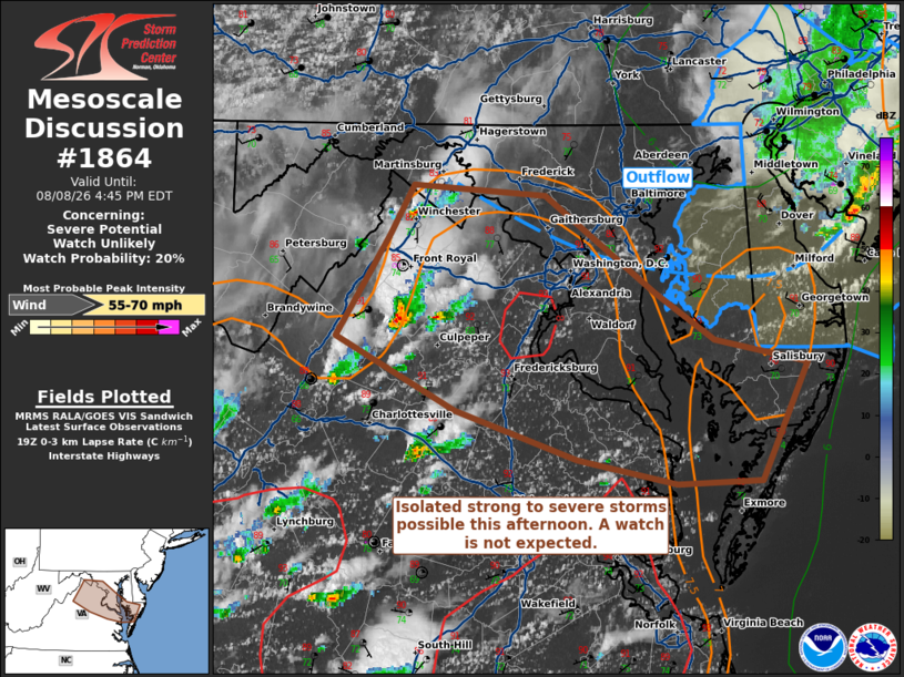
   Areas affected...Northern Virginia into the DelMarVa

   Concerning...Severe potential...Watch unlikely

   Valid 081908Z - 082045Z

   Probability of Watch Issuance...20 percent

   SUMMARY...Isolated wind damage is possible this afternoon where
   low-level lapse rates remain steep south of convective outflow. A
   watch is not anticipated this afternoon.

   DISCUSSION...Isolated cells near the Blue Ridge will continue
   eastward this afternoon. Pockets of steep low-level lapse rates will
   promote potential for isolated strong/damaging wind gusts. The main
   corridor or risk will occur along and south of an outflow boundary
   that is currently near Washington DC eastward into central/southern
   Delaware. 0-6 km shear off of the KLWX VAD is around 35 kts which
   would support marginally organized storms. The threat is likely to
   remain isolated unless clustering can occur.

   ..Wendt/Hart.. 08/08/2026

   ...Please see www.spc.noaa.gov for graphic product...

   ATTN...WFO...PHI...AKQ...LWX...

   LAT...LON   39097834 39387816 39327721 38777643 38497600 38367533
               37697566 37687627 37817699 38097787 38517872 39097834

   MOST PROBABLE PEAK WIND GUST...55-70 MPH
|
|
|
Top/All Mesoscale Discussions/Forecast Products/Home |
|
Source link