

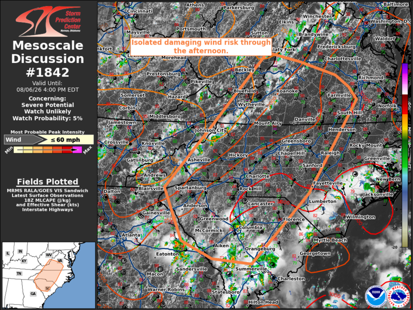
| Mesoscale Discussion 1842 | |
| < Previous MD | |

|
|
   Mesoscale Discussion 1842
   NWS Storm Prediction Center Norman OK
   0106 PM CDT Thu Aug 06 2026

   Areas affected...portions of the Carolinas and southern Virginia

   Concerning...Severe potential...Watch unlikely

   Valid 061806Z - 062000Z

   Probability of Watch Issuance...5 percent

   SUMMARY...Widely scattered thunderstorms to increase in coverage
   through the afternoon with localized damaging wind potential.

   DISCUSSION...Thunderstorms will increase in coverage though the
   afternoon across the Carolinas into southern Virginia. Daytime
   heating has allowed for temperatures in the mid 80s to 90s F. This
   is contributing to steepening low-level lapse rates and moderate
   instability. Though deep layer flow is weak, the steep low-level
   lapse rates and very moist profiles may support a few instances of
   wet microbursts. Overall, this potential is expected to remain
   fairly isolated, precluding the need for a watch.

   ..Thornton/Gleason.. 08/06/2026

   ...Please see www.spc.noaa.gov for graphic product...

   ATTN...WFO...AKQ...LWX...RAH...ILM...RNK...CHS...RLX...CAE...
   GSP...MRX...FFC...

   LAT...LON   36348196 38278016 38057920 37727812 37427773 37117750
               34897896 33208063 33328176 33758266 35028317 36348196

   MOST PROBABLE PEAK WIND GUST...UP TO 60 MPH
|
|
|
Top/All Mesoscale Discussions/Forecast Products/Home |
|
Source link