

| Mesoscale Discussion 1759 | |
| < Previous MD | |

|
|
   Mesoscale Discussion 1759
   NWS Storm Prediction Center Norman OK
   0752 AM CDT Mon Jul 27 2026

   Areas affected...Northeast Illinois into Northern Indiana and
   southwest lower Michigan

   Concerning...Severe potential...Watch possible

   Valid 271252Z - 271445Z

   Probability of Watch Issuance...40 percent

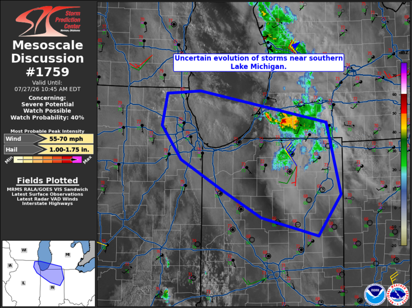
   SUMMARY...A watch is possible this morning for the lower Lake
   Michigan vicinity, though uncertainty remains high. Convective
   trends will need to be monitored this morning.

   DISCUSSION...Current radar CAPPI trends suggest that the storm
   ongoing in southwest lower Michigan has trended down in intensity
   over the past 30 minutes. That said, model guidance such as the RRFS
   and HRRR continue to highlight the southern Lake Michigan vicinity
   as an area for possible development/intensification later this
   morning. Objective mesoanalysis shows strong to extreme buoyancy
   across northern Illinois into parts of northern Indiana. Morning
   observed soundings from the region show similar MLCAPE values as
   well as steep mid-level lapse rates and strong shear. Forcing for
   ascent will be nebulous and cloud cover/capping also limits
   confidence on where, or if, additional severe storms will develop
   later this morning. However, visible satellite trends show areas of
   convective turrets from northeast Illinois into southern Lake
   Michigan. This area will need to be monitored for a possible watch
   though uncertainty in this scenario is admittedly high.

   ..Wendt/Guyer.. 07/27/2026

   ...Please see www.spc.noaa.gov for graphic product...

   ATTN...WFO...IWX...GRR...IND...LOT...

   LAT...LON   40448579 40598638 40978710 41438793 41948832 42408822
               42448756 41988510 40928484 40318528 40448579

   MOST PROBABLE PEAK WIND GUST...55-70 MPH
   MOST PROBABLE PEAK HAIL SIZE...1.00-1.75 IN
|
|
|
Top/All Mesoscale Discussions/Forecast Products/Home |
|
Source link