

| Mesoscale Discussion 1715 | |
| < Previous MD | |

|
|
   Mesoscale Discussion 1715
   NWS Storm Prediction Center Norman OK
   0113 PM CDT Thu Jul 23 2026

   Areas affected...northeast New Mexico...southeast
   Colorado...southwest Kansas and the Oklahoma Panhandle

   Concerning...Severe potential...Watch unlikely

   Valid 231813Z - 231945Z

   Probability of Watch Issuance...20 percent

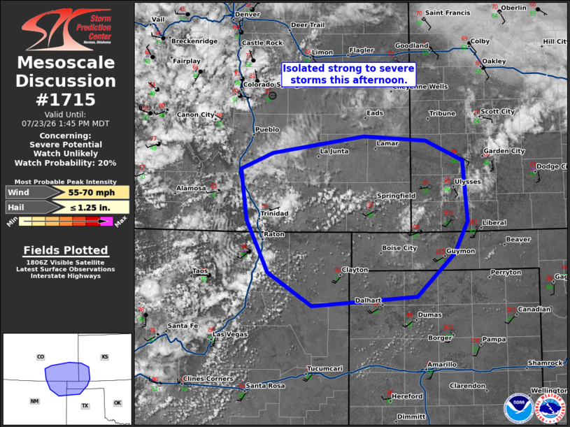
   SUMMARY...Isolated strong to severe storms this afternoon.

   DISCUSSION...Storms have started to develop over the higher terrain
   near the Raton Mesa. Temperatures in the upper 90sF with dewpoints
   near 50F in the adjacent Plains have mostly eroded CINH across the
   area. While instability remains relatively weak, it may be
   sufficient to maintain these storms as they move off the higher
   terrain and eventually into a more unstable airmass to the east.

   Shear is mostly weak, but steep low-level lapse rates will support
   some threat for isolated strong to severe wind gusts. In the short
   term, the next 1 to 2 hours, watch potential is low. However, as
   further destabilization continues and storms move toward the more
   favorable airmass across southwest Kansas, watch potential will
   increase later this afternoon and into the evening.

   ..Bentley/Smith.. 07/23/2026

   ...Please see www.spc.noaa.gov for graphic product...

   ATTN...WFO...DDC...AMA...PUB...ABQ...

   LAT...LON   36460434 37150470 37810479 38010427 38240280 38170180
               37920119 37130112 36720134 36160195 36040363 36460434

   MOST PROBABLE PEAK WIND GUST...55-70 MPH
   MOST PROBABLE PEAK HAIL SIZE...UP TO 1.25 IN
|
|
|
Top/All Mesoscale Discussions/Forecast Products/Home |
|
Source link