

| Mesoscale Discussion 1653 | |
| < Previous MD | |

|
|
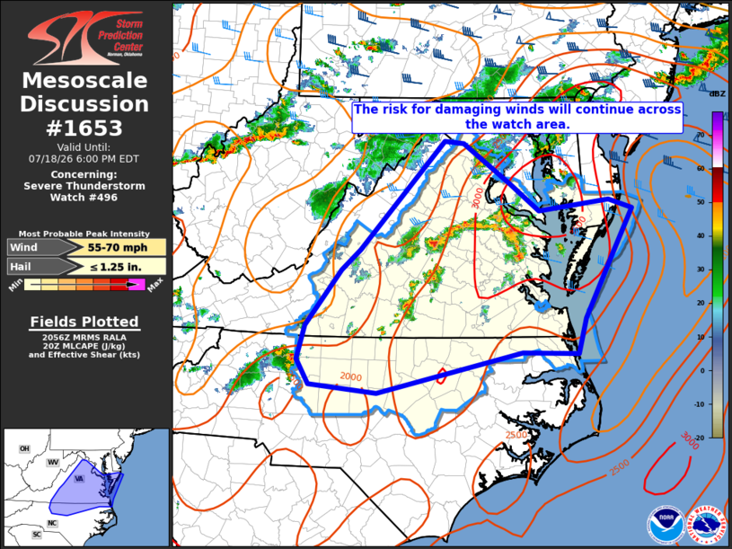
Mesoscale Discussion 1653 NWS Storm Prediction Center Norman OK 0358 PM CDT Sat Jul 18 2026 Areas affected...portions of central and eastern Virginia...southeast Maryland Concerning...Severe Thunderstorm Watch 496... Valid 182058Z - 182200Z The severe weather threat for Severe Thunderstorm Watch 496 continues. SUMMARY...Severe thunderstorms will continue to pose a risk for damaging wind gusts and isolated large hail through early evening. DISCUSSION...Several clusters of severe thunderstorms continue along a confluence zone from central VA south across western NC at 2045z, and these storms will continue to move east across the watch area through early evening. With strong instability and modest westerly deep-layer shear remaining in place, storms will continue to pose a severe risk over the next few hours. Damaging gusts remain the primary severe hazard, however isolated instances of large hail remain possible with the most intense storms. ..Bunting.. 07/18/2026 ...Please see www.spc.noaa.gov for graphic product... ATTN...WFO...AKQ...LWX...RAH...RNK... LAT...LON 39117768 38587690 38227642 38357526 38237487 37617521 36787566 36327580 36347672 35797911 35908023 36238043 36698030 37427971 37697940 39157800 39117768 MOST PROBABLE PEAK WIND GUST...55-70 MPH MOST PROBABLE PEAK HAIL SIZE...UP TO 1.25 IN |
|
|
Top/All Mesoscale Discussions/Forecast Products/Home |
|
Source link