

| Mesoscale Discussion 1620 | |
| < Previous MD | |

|
|
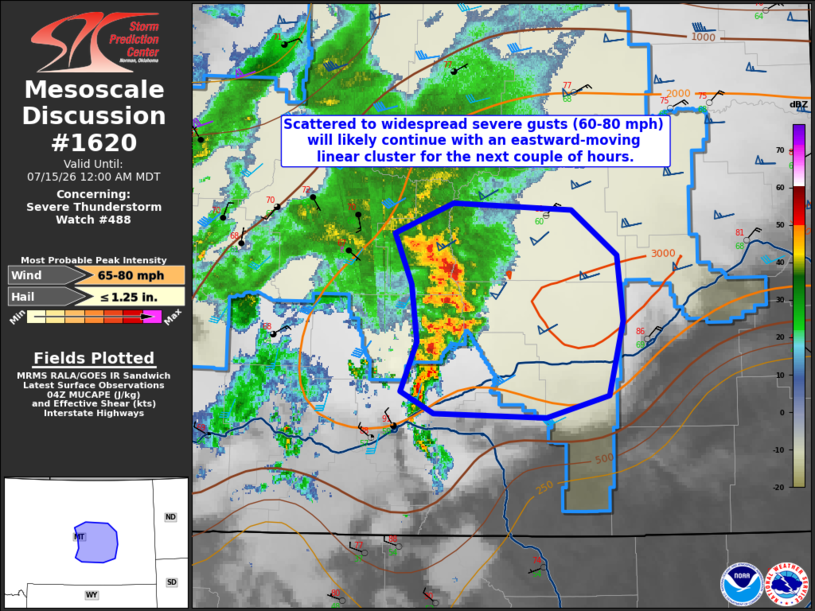
Mesoscale Discussion 1620 NWS Storm Prediction Center Norman OK 1123 PM CDT Tue Jul 14 2026 Areas affected...east-central MT Concerning...Severe Thunderstorm Watch 488... Valid 150423Z - 150600Z The severe weather threat for Severe Thunderstorm Watch 488 continues. SUMMARY...Scattered to widespread severe gusts (60-80 mph) will likely continue with an eastward-moving linear cluster for the next couple of hours. DISCUSSION...Radar-mosaic and IR composite imagery show a mature linear cluster with 50-kft echo tops over Petroleum into Yellowstone counties moving east. Surface observations indicate temperatures are still warm and in the 80s F with lower to mid 60s F dewpoints over Garfield into northern Rosebud counties in eastern MT. HRRR-based objective analysis implies MUCAPE 2000-3000 J/kg over eastern MT with an easterly 40-kt 850-mb LLJ maintaining a moist fetch into the area immediately east of the linear cluster. Given the strengthening low-level flow with height veering to weaker southwesterly flow in the midlevels (yielding 50-kt effective shear), the resultant wind profile will continue to strongly promote a linear storm mode. Severe gusts will be the primary severe hazard, but there may be a localized threat for large hail occurring intermittently with southern flanking updrafts as this complex moves east during the early overnight. ..Smith.. 07/15/2026 ...Please see www.spc.noaa.gov for graphic product... ATTN...WFO...BYZ...GGW... LAT...LON 46040845 46400828 46820835 47200852 47410790 47360666 47030617 46560611 46020626 45860692 45880810 46040845 MOST PROBABLE PEAK WIND GUST...65-80 MPH MOST PROBABLE PEAK HAIL SIZE...UP TO 1.25 IN |
|
|
Top/All Mesoscale Discussions/Forecast Products/Home |
|
Source link