

| Mesoscale Discussion 1612 | |
| < Previous MD | |

|
|
   Mesoscale Discussion 1612
   NWS Storm Prediction Center Norman OK
   0424 PM CDT Mon Jul 13 2026

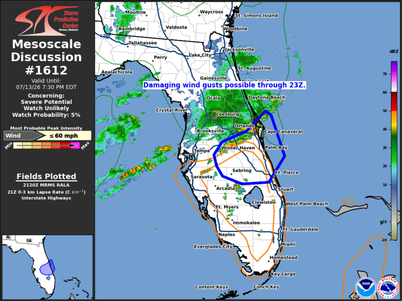
   Areas affected...Portions of the central and eastern Florida
   Peninsula

   Concerning...Severe potential...Watch unlikely

   Valid 132124Z - 132330Z

   Probability of Watch Issuance...5 percent

   SUMMARY...Scattered thunderstorms will continue to develop and move
   southeastward across the central FL Peninsula through this evening,
   accompanied by damaging wind gusts up to 60 mph.

   DISCUSSION...Surface temperatures in the low 90s combined with
   dewpoints in the mid to upper 70s are yielding a moderately unstable
   environment ahead of a cluster of congealing thunderstorms moving
   southeast across the central FL Peninsula late this afternoon.
   Low-level lapse rates peaking near 7.5 C/km, storm mergers, and a
   deepening cold pool will continue to support a threat of severe,
   damaging wind gusts up to 60 mph through at least 23Z. Given the
   localized nature of the threat, a watch is not expected at this
   time.

   ..Barnes/Smith.. 07/13/2026

   ...Please see www.spc.noaa.gov for graphic product...

   ATTN...WFO...MLB...TBW...

   LAT...LON   28508104 28978054 28868039 27908003 27308046 27258116
               27438167 27678183 27938190 28238168 28508104

   MOST PROBABLE PEAK WIND GUST...UP TO 60 MPH
|
|
|
Top/All Mesoscale Discussions/Forecast Products/Home |
|
Source link