

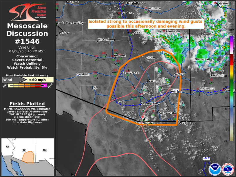
| Mesoscale Discussion 1546 | |
| < Previous MD | |

|
|
   Mesoscale Discussion 1546
   NWS Storm Prediction Center Norman OK
   0344 PM CDT Wed Jul 08 2026

   Areas affected...portions of southern/southeastern Arizona

   Concerning...Severe potential...Watch unlikely

   Valid 082044Z - 082245Z

   Probability of Watch Issuance...5 percent

   SUMMARY...Isolated to widely scattered thunderstorm development is
   expected this afternoon, with strong to occasionally damaging wind
   gusts possible.

   DISCUSSION...Latest surface observations indicate temperatures have
   warmed into the low-100s across portions of the Southwest as of 2045
   UTC. As continued insolation results in convective temperatures
   being breached, thunderstorm coverage is expected to increase over
   the next 1-2 hours amid a plume of modestly enhanced mid-level
   moisture. This moisture is supporting weak buoyancy (200-500 J/kg
   MLCAPE) atop a deep, well-mixed boundary layer (LCLs around 3.5-4.0
   km AGL). These inverted-v thermodynamic profiles will support
   efficient evaporative cooling in downdrafts and the potential for
   strong to occasionally damaging wind gusts. Weak deep-layer flow
   (less than 15 kts sampled by the EMX VWP) and meager effective shear
   are expected to largely temper the overall severe risk. Thus, watch
   issuance is not expected.

   ..Chalmers/Thompson.. 07/08/2026

   ...Please see www.spc.noaa.gov for graphic product...

   ATTN...WFO...TWC...FGZ...PSR...

   LAT...LON   31220961 31820954 32670942 33180948 33570977 33711010
               33641063 33361142 33101180 32441209 31681232 31601229
               31241107 31220961

   MOST PROBABLE PEAK WIND GUST...UP TO 60 MPH
|
|
|
Top/All Mesoscale Discussions/Forecast Products/Home |
|
Source link