

| Mesoscale Discussion 1506 | |
| < Previous MD | |
|
|
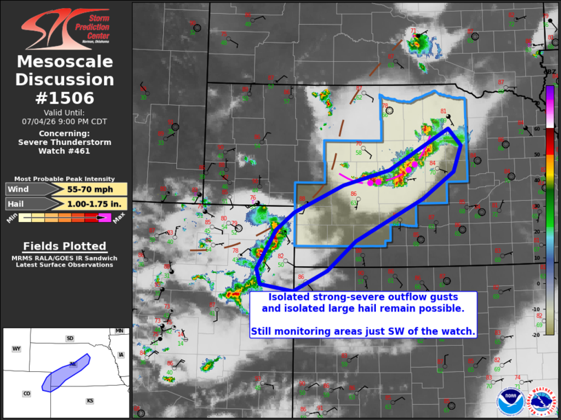
Mesoscale Discussion 1506 NWS Storm Prediction Center Norman OK 0724 PM CDT Sat Jul 04 2026 Areas affected...Central Nebraska into extreme northeast Colorado Concerning...Severe Thunderstorm Watch 461... Valid 050024Z - 050200Z The severe weather threat for Severe Thunderstorm Watch 461 continues. SUMMARY...A storm cluster in central Nebraska will continue developing south-southeastward next 1-2 hours with isolated strong-severe wind/hail. Additional cluster development in extreme northeast Colorado could pose some wind/hail threat southwest of the current watch area. DISCUSSION...Storms in central NE have grown into a small cluster that is developing south-southeastward on outflow, while newer storms have strengthened in far northeast CO. There is a small contribution to ascent in the watch area as a diffuse mid-upper trough approaches from the northwest, as well as some enhancement of northwesterly mid-upper flow (25-30 kt). The NE and CO clusters will pose a threat for isolated severe outflow gusts and large hail for the next couple of hours. After about 02-03z, storm longevity comes into question with an increase in convective inhibition and a lack of a low-level jet. Thus, it is not clear that any watch extensions or a new watch into far northeast CO/northwest KS will be necessary. ..Thompson.. 07/05/2026 ...Please see www.spc.noaa.gov for graphic product... ATTN...WFO...GID...LBF...GLD...BOU... LAT...LON 41599999 42269868 41999841 41569858 41119926 40420072 39940134 39600206 39700278 39960285 40610244 40890205 41340099 41599999 MOST PROBABLE PEAK WIND GUST...55-70 MPH MOST PROBABLE PEAK HAIL SIZE...1.00-1.75 IN |
|
|
Top/All Mesoscale Discussions/Forecast Products/Home |
|
Source link