

| Mesoscale Discussion 1504 | |
| < Previous MD | |

|
|
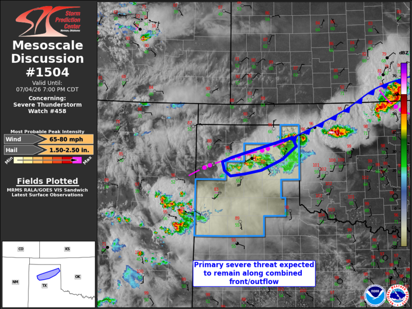
Mesoscale Discussion 1504 NWS Storm Prediction Center Norman OK 0555 PM CDT Sat Jul 04 2026 Areas affected...The Texas Panhandle and South Plains Concerning...Severe Thunderstorm Watch 458... Valid 042255Z - 050000Z The severe weather threat for Severe Thunderstorm Watch 458 continues. SUMMARY...Large hail and severe outflow gust threat will remain focused along a combined front/outflow across the Texas Panhandle, with the potential to clear the watch early into the South Plains. DISCUSSION...Storm development has remained confined to the surface front which has been reinforced by outflow across the TX Panhandle, immediately north-through-northeast of Amarillo. The richer low-level moisture and stronger buoyancy is confined to this same zone, where deep-layer northwesterly shear is allowing storms with supercell structure to develop west-southwestward along the boundary. Farther south, moisture and temperatures are reduced beneath substantial anvil shading from the convection in eastern NM. The potential for additional storm development into the South Plains appears questionable, and this portion of the watch could be cleared well before watch expiration. ..Thompson.. 07/04/2026 ...Please see www.spc.noaa.gov for graphic product... ATTN...WFO...AMA... LAT...LON 35880139 36050070 36200019 35980007 35670048 35400110 35310161 35260201 35390220 35610225 35710200 35880139 MOST PROBABLE PEAK WIND GUST...65-80 MPH MOST PROBABLE PEAK HAIL SIZE...1.50-2.50 IN |
|
|
Top/All Mesoscale Discussions/Forecast Products/Home |
|
Source link