

| Mesoscale Discussion 1495 | |
| < Previous MD | |

|
|
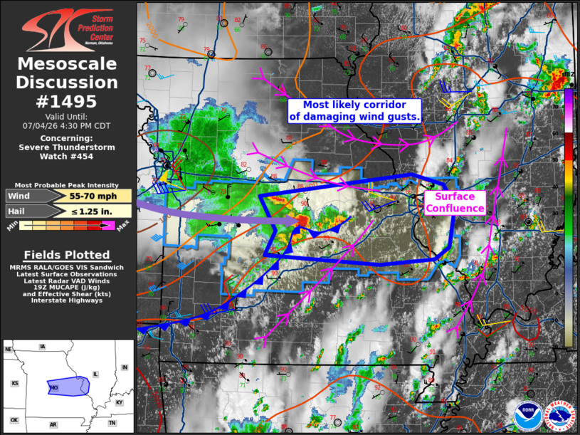
Mesoscale Discussion 1495 NWS Storm Prediction Center Norman OK 0236 PM CDT Sat Jul 04 2026 Areas affected...central into eastern Missouri and far west-central Illinois Concerning...Severe Thunderstorm Watch 454... Valid 041936Z - 042130Z The severe weather threat for Severe Thunderstorm Watch 454 continues. SUMMARY...A small but long-lived storm/bow may continue to produce damaging winds from central Missouri toward the St. Louis vicinity this afternoon. DISCUSSION...An eastward-moving storm complex persists this afternoon, producing areas of wind damage from west-central into central MO. This bow is now moving along a confluence zone which can be seen in surface obs and also by virtue of an east-west corridor of enhanced CU and isolated leading convection. The environment remains quite unstable from MO into southern IL, and daytime heating continues. The bow has fluctuated in intensity at times, as outflow pushes ahead of the system. However, portions of this system may regenerate and continue to produce periodic wind damage as the outflow surge continues east. ..Jewell.. 07/04/2026 ...Please see www.spc.noaa.gov for graphic product... ATTN...WFO...LSX...SGF...EAX... LAT...LON 37849095 37959289 38289272 38759299 39059039 38908985 38618967 38068976 37909002 37849095 MOST PROBABLE PEAK WIND GUST...55-70 MPH MOST PROBABLE PEAK HAIL SIZE...UP TO 1.25 IN |
|
|
Top/All Mesoscale Discussions/Forecast Products/Home |
|
Source link