2024-06-30 16:48:03
1719780622
|
|
| Mesoscale Discussion 1495 | |
| < Previous MD | |

|
|
   Mesoscale Discussion 1495
   NWS Storm Prediction Center Norman OK
   0345 PM CDT Sun Jun 30 2024

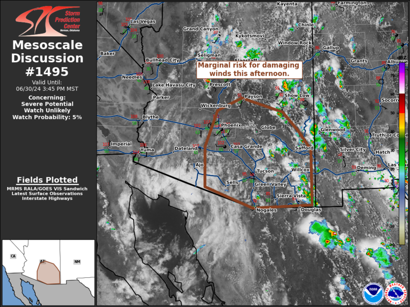
   Areas affected...east-central and southeastern Arizona

   Concerning...Severe potential...Watch unlikely

   Valid 302045Z - 302245Z

   Probability of Watch Issuance...5 percent

   SUMMARY...Scattered thunderstorm activity with potential for strong
   to severe wind to continue through the afternoon.

   DISCUSSION...Thunderstorm activity is increasing across portions of
   southern and central Arizona this afternoon. Daytime heating has
   yielded MLCAPE around 500-1000 J/kg. This, in addition to steep low
   to mid-level lapse rates and modest mid-level flow, will result in a
   mix of cells and clusters with potential for strong to severe
   downburst winds and instances of small hail. This threat will likely
   remain localized and diminish after loss of daytime heating,
   precluding the need for a watch.

   ..Thornton/Gleason.. 06/30/2024

   ...Please see www.spc.noaa.gov for graphic product...

   ATTN...WFO...TWC...FGZ...PSR...

   LAT...LON   31881252 32961254 33931215 34281138 33901006 33390956
               32870917 31380916 31321101 31881252
|
|
|
Top/All Mesoscale Discussions/Forecast Products/Home |
|


