| Mesoscale Discussion 1340 | |
| < Previous MD | |

|
|
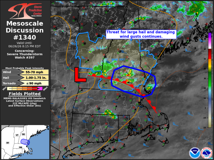
Mesoscale Discussion 1340 NWS Storm Prediction Center Norman OK 0541 PM CDT Fri Jun 26 2026 Areas affected...portions of northeastern Massachusetts and southeastern New Hampshire Concerning...Severe Thunderstorm Watch 397... Valid 262241Z - 270015Z The severe weather threat for Severe Thunderstorm Watch 397 continues. SUMMARY...The threat for isolated large hail and damaging wind gusts continues across portions of Severe Thunderstorm Watch 397. This threat should gradually diminish this evening with the loss of diurnal heating and as storms progress offshore. DISCUSSION...Isolated convection, including one persistent supercell, has continued to progress southeastward across portions of New England and along a diffuse warm front over the past 1-2 hours, with several reports of damaging wind gusts and large hail up to golf ball size noted. While the severe threat is expected to gradually diminish with time with the loss of diurnal heating and as storms progress offshore, isolated large hail (with perhaps another instance of large hail up to 1.5-1.75" in diameter) and damaging wind gusts remain possible in the meantime owing to 500 to locally 1000 J/kg MLCAPE, strong effective shear of 50+ kts, and elongated hodographs. ..Chalmers.. 06/26/2026 ...Please see www.spc.noaa.gov for graphic product... ATTN...WFO...GYX...BOX... LAT...LON 43387160 43287113 43197071 43097044 42857039 42607057 42517089 42687160 42847203 42987207 43257195 43387160 MOST PROBABLE PEAK TORNADO INTENSITY...UP TO 90 MPH MOST PROBABLE PEAK WIND GUST...55-70 MPH MOST PROBABLE PEAK HAIL SIZE...1.00-1.75 IN |
|
|
Top/All Mesoscale Discussions/Forecast Products/Home |
|
Source link