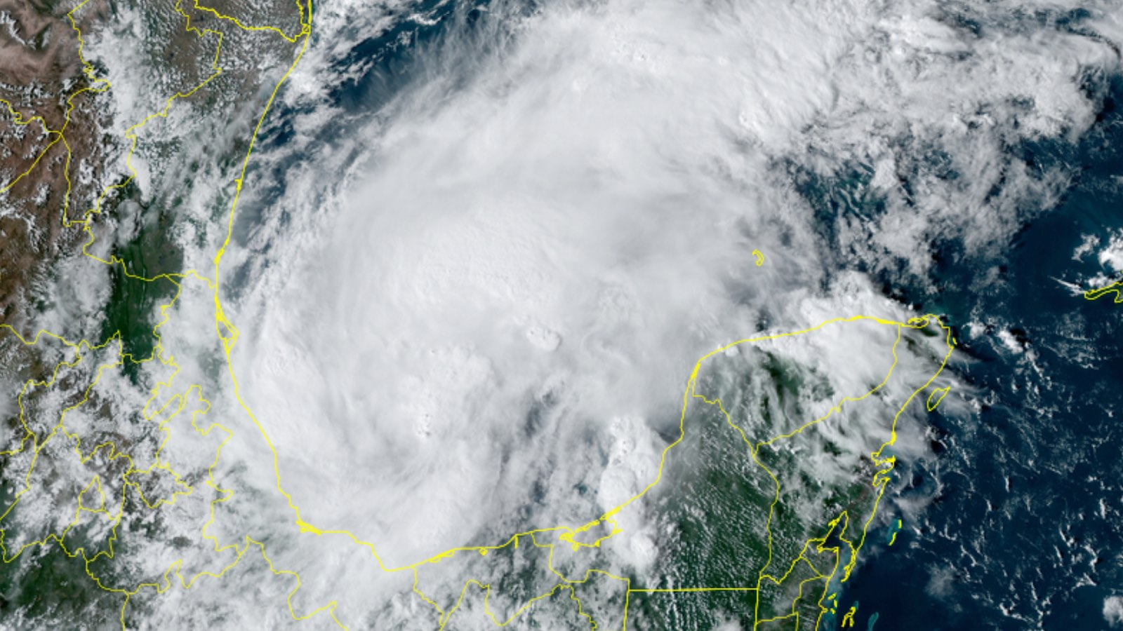
An area of disturbed weather, positioned at the north end of a broad envelope of spin and moisture that had surrounded former Hurricane Julia, has now become Tropical Storm Karl. The National Hurricane Center (NHC) launched advisories on Karl on Tuesday afternoon, October 11. Karl’s main threat will be periods of heavy rain and localized flooding in parts of Mexico near the Bay of Campeche, where Karl is expected to linger for several days before moving inland.
At 5 p.m. Tuesday, Karl was centered about 120 miles east-northeast of Veracruz in the central Bay of Campeche, drifting northwest at 6 mph with top sustained winds of just 40 mph. Showers and thunderstorms (convection) blossomed on Monday night and Tuesday, and reconnaissance flights on Tuesday afternoon confirmed a broad low-level circulation. Tropical-storm-force winds were restricted mainly to the north side of Karl.
Karl’s formation came more than a week after the average development date of the Atlantic’s eleventh named storm of the year, October 2. Despite the catastrophic landfall of category 4 Hurricane Ian, the 2022 Atlantic season as a whole remains slightly less active than the 1991-2020 average, as judged by accumulated cyclone energy to date (running about 21% below average for the date as of October 11).
Forecast for Karl
The concave shape of the Bay of Campeche is notorious for helping tropical cyclones gain spin, which could help give Karl an early boost. Sea surface temperatures are a warm 28-29 degrees Celsius (82-84 degrees Fahrenheit), and the atmosphere surrounding Karl is quite moist, with mid-level relative humidity of 75-80 percent. Wind shear will be light (10 knots or less) through Wednesday.
With all these factors favoring strengthening, Karl could become a mid-range tropical storm by Wednesday. The SHIPS rapid intensification index from 18Z (2 p.m. EDT) Tuesday has a one-in-three chance of Karl gaining 25 knots of intensity by 18Z Wednesday, which would make it a 70-mph storm. The newer DTOPS index is less bullish, giving only a 4% chance of such intensification.
Karl’s northward motion will be limited by upper-level westerly winds, now predominating over the Gulf of Mexico, that will strengthen and gain more of a northerly component over time. As a result, Karl is expected to move slowly and perhaps erratically around the western Bay of Campeche over the next couple of days. The intensifying westerly winds will lead to increased wind shear in the 15-20 knot range by Thursday, likely capping off any strengthening. NHC predicts Karl will move inland on Friday, dissipating soon afterward.
Most of Karl’s heaviest rains should remain offshore for the next day or two, but localized totals of up to 10 inches are possible on the Isthmus of Tehuantepec, just south of the storm, where rainfall will also be enhanced by the remnants of Julia (see below). The Sierra Madre Oriental range just west of the Bay of Campeche could also get pockets of heavy rain, especially as Karl inches its way west later in the week.


Julia’s remnants could develop in the Pacific later this week
Convection continues to simmer on the Pacific side of southern Mexico, where Julia’s disorganized remnants are continuing their westward trek. By late in the week, conditions might become more favorable for a new tropical cyclone to form as the residual spin and moisture progress further west. In its 2 p.m. EDT Tuesday Tropical Weather Outlook, NHC gave Julia’s remnants a near-zero chance of development in the two-day period but a 20% chance in the five-day period.
Jeff Masters contributed to this post. Website visitors can comment on “Eye on the Storm” posts (see comments policy below). Sign up to receive notices of new postings here.
Source link