(Editor’s note: A Saildrone has gathered live footage from inside Category 4 Hurricane Fiona as it threatens Atlantic Canada.)
NOAA oceanographer Greg Foltz knew it was going to be a long night last fall when he saw Hurricane Sam‘s trajectory. Glued to the National Hurricane Center data, Foltz, who works in NOAA’s Atlantic Oceanographic and Meteorological Laboratory in Miami, examined the storm’s tracking and intensity and conducted an analysis of the satellite images and data.
He needed to estimate the hurricane’s trajectory over the next 12-24 hours so he could position his instruments. He wasn’t trying to pull his costly equipment away from the hurricane’s path, though. In fact, he was doing the opposite. He wanted to position an uncrewed surface vehicle (USV) called a Saildrone right in the path of the storm. A direct hit by the ferocious Category 4 storm was just what he was looking for.
As he closely monitored the storm, Foltz sent messages to Saildrone’s “mission control” when he wanted to change the vehicle’s path. For example, if he thought the storm would veer a little further to the west, he would send the team a new waypoint to adjust it.
“It was a constant back and forth adjusting the location that we wanted the Saildrone to be in to go through the strongest part of the storm,” Foltz says. “I was directing in real time where to take the Saildrone to get it in the best spot to go through the strongest part of the hurricane, and that was exciting. I didn’t really sleep at all the night before as I was trying to get it into the right position.”
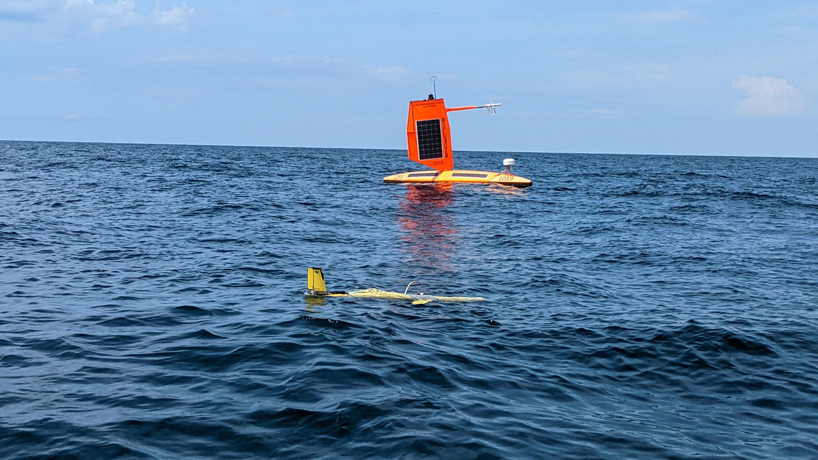
Equipped with a “hurricane wing,” the Saildrone could be remotely controlled, with scientists adjusting the sail from afar in order to steer the craft. The hurricane Saildrones differ from some of the company’s other products, which are used for projects like ocean mapping, ocean data collection, and maritime domain awareness,
“It’s that difference of a smaller, stubbier, hardier wing that we use with the hurricane drones to help improve their endurance and capability to survive during some of the very rough weather they may find themselves in during hurricane season,” says Matt Womble, Director of Ocean Data Programs for Saildrone, Inc.
As Hurricane Sam’s powerful Category 4 winds and monster waves battered the USV, the team waited and watched. Live data and video footage rolled in, allowing them a peek into the storm’s fury. After the weather calmed, they were able to steer it to Bermuda to retrieve it, mostly unscathed.
Expanding Hurricane Saildrone project this hurricane season
After last year’s successful mission, NOAA and Saildrone are expanding the project this year by adding two additional Saildrones, for a total of seven. Hurricane season runs from June to November, and this year two drones are positioned in the Gulf of Mexico and five others are in the Atlantic and Caribbean. The researchers deploy them to locations where they think there is a good chance a storm will develop. Last year, the Saildrones collected data about Hurricane Sam, in addition to four tropical storms, as well as a few weaker tropical depressions and storms.
Scientists focusing on rapid hurricane intensification …
One of the main things scientists are studying is hurricane intensification. When hurricanes rapidly intensify, people can be caught unprepared and be unable to evacuate or adequately prepare, leading to deaths and an incredible amount of destruction.
By transmitting real-time data to hurricane forecasters, they hope to be able to help improve the accuracy of forecasts in real-time, as well as improve hurricane modeling and predictions.


Climate change fuels hurricanes and creates the possibility of a storm’s becoming more intense. “The most robust effect of climate change on hurricanes, I would say, is that it increases the kind of the ‘speed limit’ you could say,” Foltz says. “The wind speed limit of hurricanes, the maximum potential intensity that a hurricane could reach, is [the effect] climate change is having.” He points out this doesn’t mean every hurricane will become stronger, but rather that it raises the ceiling for a hurricane’s maximum intensity under the right conditions.
Saildrones collect data like air and water temperature, humidity, wind speed and direction, barometric pressure, salinity, and wave height and period, and also record and transmit video. Researchers are using the data collected to learn more about a range of topics, including energy exchanges, momentum, and intensification.
Going to sleep with a Cat 1, but awakening to a Cat 4
Saildrones are one of a suite of instruments being used to study powerful ocean storms by using “co-located measurements.” These instruments collect data from different locations to provide researchers with a set of measurements to help study hurricanes. Underwater gliders can dip far below the ocean’s surface, tracking things like salinity and temperature, and ocean floats and drifters also gather data. Small uncrewed aircraft systems (sUAS) collect measurements several hundred feet above sea level, and dropsondes are deployed from “Hurricane Hunter” aircraft.
Hugh Willoughby, a tropical meteorologist and professor at Florida International University, has flown hundreds of research flights into hurricanes through his previous work for NOAA’s Hurricane Research Division and the U.S. Navy. He is hopeful Saildrone’s data collection will help save lives.
“This provides a new way of looking at an old problem where we know enough that we will realize where we misunderstand it, and that will lead to improvement of the models, which will lead to improvement of forecasts which will save peoples’ lives and property,” he says.
Foltz and colleagues are currently analyzing the data collected from last season, and preparing research papers to share their findings, while also collecting this year’s data. He says the team also is hopeful the data will be used in real-world applications that can save lives.
Saildrone’s Womble points to “the promise or the hope that the data that we collect from the Saildrones will be able to help improve hurricane intensification forecasts.” He cites a comment he heard at a kick-off event for the hurricane mission, with a scientist saying people might go to sleep expecting a Category 1 storm but wake up the next morning to find a Cat 4 bearing down on them.
“That’s a scary scenario for people [who] can go to sleep and, all of a sudden, have a much different decision matrix with very little time to make decisions for themselves,” Womble says. “The fact that the Saildrones may be able to help improve those forecasts and make those decisions easier for people, or at least give people better information to make decisions with, is something we’re excited about.”
Source link