|
|
| Mesoscale Discussion 966 | |
| < Previous MD Next MD > | |

|
|
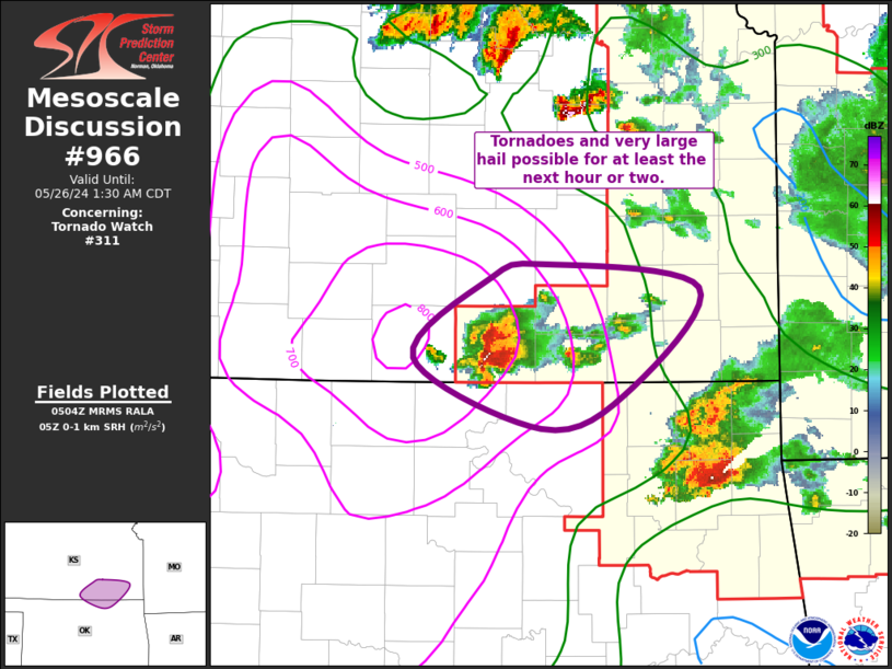
Mesoscale Discussion 0966 NWS Storm Prediction Center Norman OK 1207 AM CDT Sun May 26 2024 Areas affected...South-Central/Southeast KS...Far North-Central OK Concerning...Tornado Watch 311... Valid 260507Z - 260630Z The severe weather threat for Tornado Watch 311 continues. SUMMARY...Tornadoes and very large hail possible across south-central/southeast Kansas and far north-central Oklahoma for at least the next hour. DISCUSSION...Despite limited surface-based buoyancy and the presence of convective inhibition, initially elevated convection has recently trended towards more of a surface-based character across south-central KS, likely aided intense low-level shear in the region. Recent ICT VAD sampled over 700 m2/s2 of 0-1 km storm-relative helicity. This intense low-level shear will likely aid the updrafts in overcoming the convective inhibition in place, potential allowing for the development of tornadic supercells. Very large hail up to 3" will be possible as well. ..Mosier.. 05/26/2024 ...Please see www.spc.noaa.gov for graphic product... ATTN...WFO...TSA...ICT...OUN... LAT...LON 36719648 37159748 37659687 37739646 37589523 36929582 36719648 |
|
|
Top/All Mesoscale Discussions/Forecast Products/Home |
|


