|
|
| Mesoscale Discussion 954 | |
| < Previous MD | |

|
|
   Mesoscale Discussion 0954
   NWS Storm Prediction Center Norman OK
   0256 PM CDT Sat May 25 2024

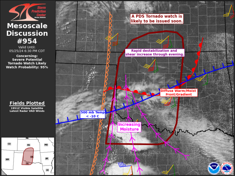
   Areas affected...much of western into central Oklahoma...northwest
   Texas...and south-central Kansas

   Concerning...Severe potential...Tornado Watch likely

   Valid 251956Z - 252330Z

   Probability of Watch Issuance...95 percent

   SUMMARY...Tornadic supercells capable of dangerous tornadoes and
   extreme hail are expected to develop from northwest Texas into much
   of southwest and southern Oklahoma through evening. A similar threat
   is expected to develop with rapidly changing conditions this evening
   from northern Oklahoma into southern Kansas.

   DISCUSSION...Moisture continues to rapidly increase from northwest
   TX into southern OK, with 70s F dewpoints and increasing shear.
   Extreme instability will favor particularly large supercells, with
   right-moving cells possibly traveling for over 100 miles, producing
   periodic tornadoes and giant hail.

   The initial threat is from activity now developing over northwest
   TX, and this should spread north of the Red River and move into
   south-central OK by evening.

   Farther north, destabilization and a rapidly increasing low-level
   jet will result in a developing tornadic supercell threat into the
   evening. Storms may initialize near the TX Panhandle/OK border ot
   even toward the KS border over the next few hours.

   ..Jewell/Bunting.. 05/25/2024

   ...Please see www.spc.noaa.gov for graphic product...

   ATTN...WFO...TSA...ICT...FWD...OUN...DDC...SJT...LUB...AMA...

   LAT...LON   33370044 35180015 36779989 37479925 37759846 37849755
               37779704 37569676 37079671 34199711 33789729 33429769
               33369801 33370044
|
|
|
Top/All Mesoscale Discussions/Forecast Products/Home |
|


