|
|
| Mesoscale Discussion 944 | |
| < Previous MD | |

|
|
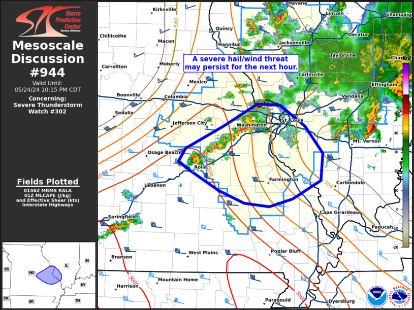
Mesoscale Discussion 0944 NWS Storm Prediction Center Norman OK 0849 PM CDT Fri May 24 2024 Areas affected...Eastern Missouri and far western Illinois Concerning...Severe Thunderstorm Watch 302... Valid 250149Z - 250315Z The severe weather threat for Severe Thunderstorm Watch 302 continues. SUMMARY...A severe hail/wind threat may persist for another hour or two across eastern Missouri and far western Illinois as a line of thunderstorms approaches the Missouri River. DISCUSSION...Over the past hour, convective intensity has largely waned across much of WW 302 - mainly due to an acceleration of an undercutting outflow boundary/cold pool expansion. The anticipated upscale growth into a more linear cluster does not appear to be materializing as expected; however, convective development continues along an eastward migrating cold front, including embedded supercells based on KLSX imagery. Nearly straight hodographs above 1 km (as sampled by the KLSX VWP) with deep-layer shear vectors somewhat orthogonal to the front will continue to promote line-embedded supercells as this activity begins to propagate east/southeast along a diffuse buoyancy gradient (which is roughly situated along the MO river). The severe threat for much of WW 302 will continue to diminish amid the onset of nocturnal cooling and further cold pool expansion to the north of the St. Louis area, but a more focused severe threat may persist downstream for the next hour or so with an attendant risk of large hail and damaging winds. ..Moore.. 05/25/2024 ...Please see www.spc.noaa.gov for graphic product... ATTN...WFO...PAH...LSX...SGF... LAT...LON 38279191 38599123 38909060 38889020 38588975 38198943 37818946 37548997 37449040 37489084 37669130 37959184 38089203 38279191 |
|
|
Top/All Mesoscale Discussions/Forecast Products/Home |
|


