|
|
| Mesoscale Discussion 1149 | |
| < Previous MD | |

|
|
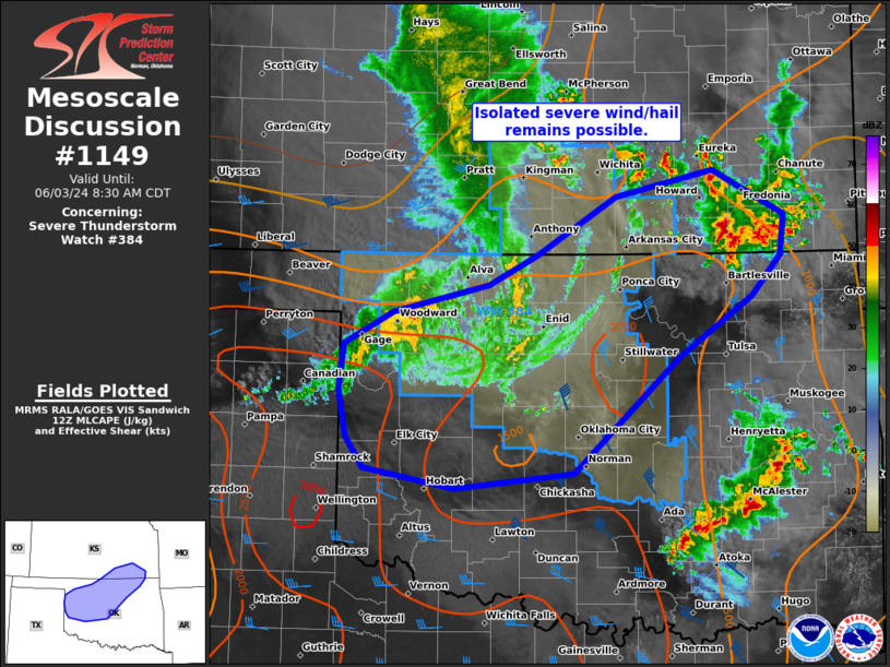
Mesoscale Discussion 1149 NWS Storm Prediction Center Norman OK 0733 AM CDT Mon Jun 03 2024 Areas affected...Western to northern OK and southeast KS Concerning...Severe Thunderstorm Watch 384... Valid 031233Z - 031330Z The severe weather threat for Severe Thunderstorm Watch 384 continues. SUMMARY...While the overall severe threat has diminished, potential still exists for an uptick in convective intensity later this morning. DISCUSSION...The short QLCS that was responsible for a swath of measured severe wind gusts from Garden City to Medicine Lodge weakened considerably across parts of north-central OK/south-central KS. The trailing remnants still persist across a part of northwest OK. The 12Z Amarillo sounding sampled substantially large MLCIN with a very stout elevated mixed layer characterized by lapse rates to around 9.5 C/km. With stratus evident downstream across the southeast TX Panhandle into southwest/south-central OK, it is possible that may continue to decay until late morning/midday. Otherwise, isolated/marginal severe hail will be possible over southeast KS in the near-term ahead of the remnant MCV. An additional watch is unlikely for this activity. ..Grams.. 06/03/2024 ...Please see www.spc.noaa.gov for graphic product... ATTN...WFO...TSA...ICT...OUN...AMA... LAT...LON 37709613 37329539 36989543 36649573 36139649 35159758 35029880 35199974 35469993 35850000 36239996 36519944 36749845 36999796 37479714 37709613 |
|
|
Top/All Mesoscale Discussions/Forecast Products/Home |
|


