|
|
| Mesoscale Discussion 1093 | |
| < Previous MD | |

|
|
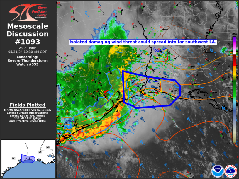
Mesoscale Discussion 1093 NWS Storm Prediction Center Norman OK 0857 AM CDT Fri May 31 2024 Areas affected...Upper TX Coast into southwest LA Concerning...Severe Thunderstorm Watch 359... Valid 311357Z - 311530Z The severe weather threat for Severe Thunderstorm Watch 359 continues. SUMMARY...An isolated damaging-wind threat could spread into parts of extreme southwest Louisiana later this morning. DISCUSSION...The northern portion of a long-lived QLCS is moving slowly eastward near the upper TX coast this morning, with the stronger portion of the QLCS currently moving offshore farther southwest. The 12Z LCH sounding depicted moderate MUCAPE, but also near-surface stability and only modest low-level flow. Somewhat warmer and more unstable conditions are noted downstream near the immediate coast, where some increasing cumulus has been noted. In areas where continued modest pre-storm heating can occur, some damaging-wind threat could persist through mid morning, though the environment is expected to remain only marginally favorable for organized convection. With the short-term threat expected to remain relatively confined to near-coastal areas of southwest LA, new watch issuance is currently considered unlikely. ..Dean/Smith.. 05/31/2024 ...Please see www.spc.noaa.gov for graphic product... ATTN...WFO...LCH...HGX... LAT...LON 30429457 30249367 30149269 29949250 29679252 29349289 29279410 29329415 29449452 30429457 |
|
|
Top/All Mesoscale Discussions/Forecast Products/Home |
|


