|
|
| Mesoscale Discussion 1089 | |
| < Previous MD | |

|
|
   Mesoscale Discussion 1089
   NWS Storm Prediction Center Norman OK
   1221 AM CDT Fri May 31 2024

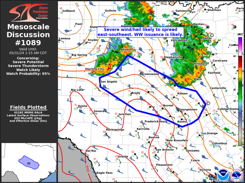
   Areas affected...Big Country to central TX

   Concerning...Severe potential...Severe Thunderstorm Watch likely

   Valid 310521Z - 310615Z

   Probability of Watch Issuance...95 percent

   SUMMARY...A severe thunderstorm watch will likely be needed as an
   MCS over the Big Country and Concho Valley continues for the next
   several hours into central Texas.

   DISCUSSION...An intensifying MCS over the TX Big Country has already
   produced hail reported up to 2.5 inches and a measured wind gust of
   55 mph at the Fort Chadbourne West Texas Mesonet site. This MCS will
   likely propagate along the outflow from a leading MCS over central
   TX. A pronounced MLCAPE gradient with large buoyancy centered over
   parts of the Edwards Plateau into south-central TX will aid in
   maintaining potential for embedded hail with an increasing risk for
   severe wind gusts through the pre-dawn hours.

   ..Grams/Thompson.. 05/31/2024

   ...Please see www.spc.noaa.gov for graphic product...

   ATTN...WFO...HGX...FWD...EWX...SJT...

   LAT...LON   32329945 32189912 31849839 31589783 31399768 31239703
               30849672 30419697 30279722 30169754 30499833 30669913
               31370040 31630044 31849990 32329945
|
|
|
Top/All Mesoscale Discussions/Forecast Products/Home |
|


