|
|
| Mesoscale Discussion 1059 | |
| < Previous MD Next MD > | |

|
|
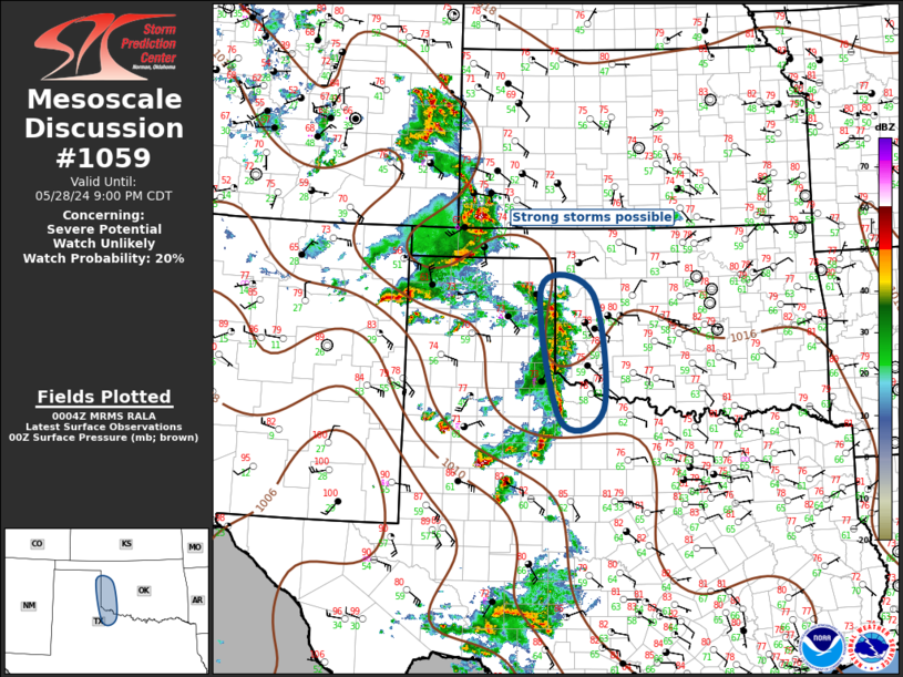
Mesoscale Discussion 1059 NWS Storm Prediction Center Norman OK 0706 PM CDT Tue May 28 2024 Areas affected...Southern Plains Concerning...Severe potential...Watch unlikely Valid 290006Z - 290200Z Probability of Watch Issuance...20 percent SUMMARY...Marginally severe hail and gusty winds may accompany convection this evening. DISCUSSION...Convection that developed across the TX Panhandle late this afternoon has evolved into a squall line that is now propagating into the western parts of OK and northwest TX. A modest cold pool has formed in the wake of this activity which appears to be aided by a weak short-wave trough progressing through the ridge. With the LLJ expected to remain focused across the southern High Plains, and much weaker buoyancy currently observed over central OK, this activity is not expected to be particularly strong as it advances east. Some hail could approach severe levels, otherwise gusty winds are the primary concern. ..Darrow/Smith.. 05/29/2024 ...Please see www.spc.noaa.gov for graphic product... ATTN...WFO...OUN...LUB...AMA... LAT...LON 33799990 36000028 35909922 33979901 33799990 |
|
|
Top/All Mesoscale Discussions/Forecast Products/Home |
|


