| Mesoscale Discussion 1044 | |
| < Previous MD | |

|
|
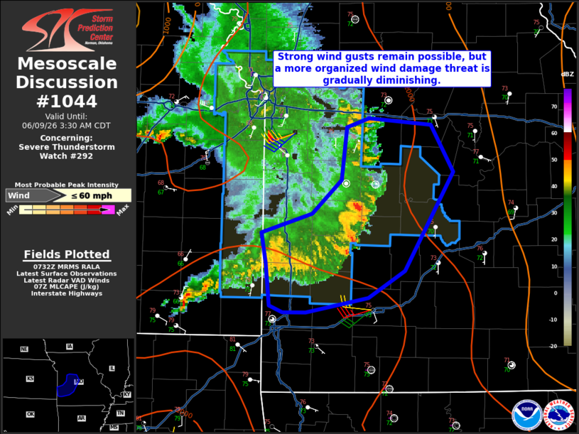
Mesoscale Discussion 1044 NWS Storm Prediction Center Norman OK 0235 AM CDT Tue Jun 09 2026 Areas affected...Central into southwest Missouri Concerning...Severe Thunderstorm Watch 292... Valid 090735Z - 090830Z The severe weather threat for Severe Thunderstorm Watch 292 continues. SUMMARY...Occasional strong wind gusts may still produce damage, but the threat will become more isolated with time. No additional watches are expected this morning. DISCUSSION...A general weakening trend has been observed in MRMS CAPPI data with an MCS moving into central/southwest Missouri. Slightly greater MLCAPE is still present in southwest Missouri and the convection may tend to move in that direction, but given the 1-2 F surface cooling that has occurred in the last hour suggests MLCIN is also increasing. The expectation is for a few strong wind gusts will be possible, but a more organized severe threat is becoming less likely. No downstream watches are anticipated this morning. ..Wendt.. 06/09/2026 ...Please see www.spc.noaa.gov for graphic product... ATTN...WFO...LSX...SGF...EAX... LAT...LON 37279453 37649457 37919462 38089405 38389373 38859367 38949341 38889272 38469247 37579301 37339342 37219413 37209439 37279453 MOST PROBABLE PEAK WIND GUST...UP TO 60 MPH |
|
|
Top/All Mesoscale Discussions/Forecast Products/Home |
|
Source link