|
|
| Mesoscale Discussion 1040 | |
| < Previous MD Next MD > | |

|
|
   Mesoscale Discussion 1040
   NWS Storm Prediction Center Norman OK
   1201 PM CDT Tue May 28 2024

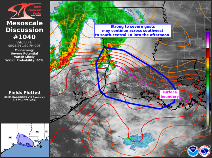
   Areas affected...southwest to south-central Louisiana

   Concerning...Severe potential...Watch likely

   Valid 281701Z - 281830Z

   Probability of Watch Issuance...80 percent

   SUMMARY...Strong to severe thunderstorms may persist southeast
   across southwest and south-central Louisiana this afternoon.
   Damaging gusts will be the main hazard with this activity. A severe
   thunderstorm watch may be needed soon.

   DISCUSSION...A cluster of strong to severe thunderstorms ongoing
   near the TX/LA border at midday may persist southeast through the
   afternoon along a surface boundary. A very moist (mid 70s to near 80
   F dewpoints) boundary-layer exists across the area beneath very
   steep midlevel lapse rates (8 C/km) and strong vertical shear (40+
   kt effective shear). While this cluster of storms is less intense
   compared to early in the morning, the downstream environment remains
   favorable for organized severe. A severe thunderstorm watch may be
   needed soon if current trends persist/intensify.

   ..Leitman/Hart.. 05/28/2024

   ...Please see www.spc.noaa.gov for graphic product...

   ATTN...WFO...LIX...LCH...SHV...

   LAT...LON   31489379 31379292 30769175 30309103 29909068 29389075
               29159135 29369264 29629367 29879397 30889413 31489379
|
|
|
Top/All Mesoscale Discussions/Forecast Products/Home |
|


