|
|
| Mesoscale Discussion 1034 | |
| < Previous MD Next MD > | |

|
|
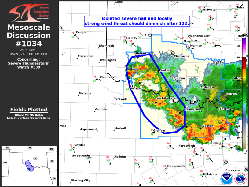
Mesoscale Discussion 1034 NWS Storm Prediction Center Norman OK 0555 AM CDT Tue May 28 2024 Areas affected...Southwest OK and western north TX Concerning...Severe Thunderstorm Watch 339... Valid 281055Z - 281200Z The severe weather threat for Severe Thunderstorm Watch 339 continues. SUMMARY...Isolated severe hail and locally strong wind gusts should diminish after 12Z, although convection will likely persist through mid-morning. With WW 339 set to expire at 12Z, an additional watch issuance is not expected. DISCUSSION...While the bulk of significant severe wind potential is moving from WW 339 into WW 340, upstream convection lingers northwestward into southwest OK. MCS convective outflow has moved far enough west that the bulk of this regenerative activity is largely training across the same axis. It appears over the next hour or so that the large hail threat will become fairly marginal as further convective overturning occurs. ..Grams.. 05/28/2024 ...Please see www.spc.noaa.gov for graphic product... ATTN...WFO...FWD...OUN... LAT...LON 35069867 34329810 33749762 33289762 33119788 33099824 33289855 33539883 34199924 34559935 34769937 34999922 35069867 |
|
|
Top/All Mesoscale Discussions/Forecast Products/Home |
|


