|
|
| Mesoscale Discussion 1033 | |
| < Previous MD | |

|
|
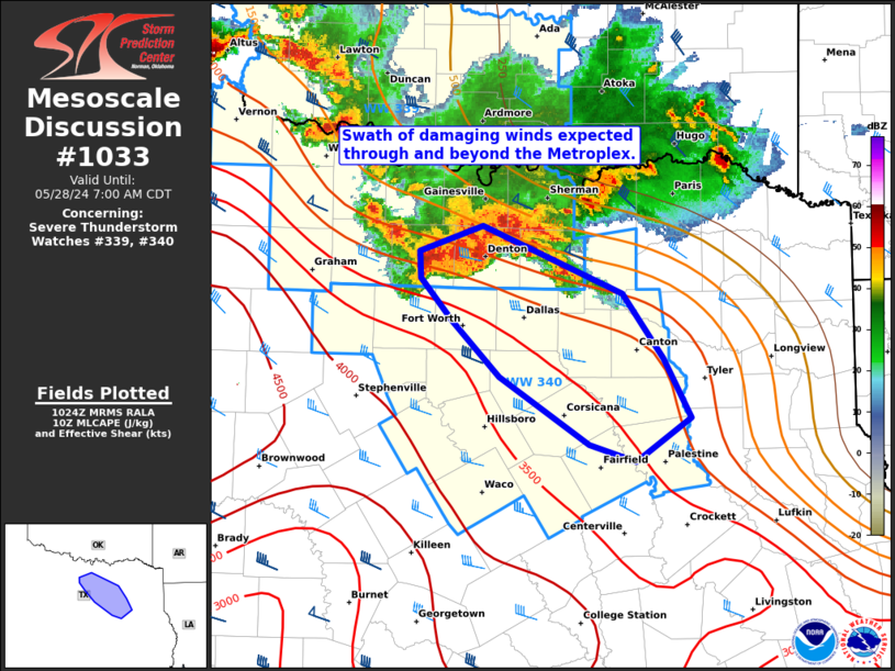
Mesoscale Discussion 1033 NWS Storm Prediction Center Norman OK 0526 AM CDT Tue May 28 2024 Areas affected...North TX Concerning...Severe Thunderstorm Watch 339...340... Valid 281026Z - 281200Z The severe weather threat for Severe Thunderstorm Watch 339, 340 continues. SUMMARY...A swath of damaging winds with severe gusts of 65-80 mph and embedded large hail to around golf-ball size appears likely to spread across the Metroplex and southeastward. DISCUSSION...A strengthening and deepening complex of severe thunderstorms (with echo tops to around 60k ft) will progress through the Metroplex over the next couple hours. An initial measured severe gust of 61 mph was recently reported in Denton County, and gust potential will likely increase as the complex moves into richer boundary-layer moisture characterized by mid 70s surface dew points across the central/southern Metroplex. This cluster may accelerate as the cold pool further deepens, and likely propagates southeastward along the pronounced MLCAPE gradient extending into southeast TX. ..Grams.. 05/28/2024 ...Please see www.spc.noaa.gov for graphic product... ATTN...WFO...SHV...FWD... LAT...LON 33439715 32949598 32489563 32079540 31769587 31889626 32359701 32759739 33069767 33259768 33439715 |
|
|
Top/All Mesoscale Discussions/Forecast Products/Home |
|


