|
|
| Mesoscale Discussion 1029 | |
| < Previous MD | |

|
|
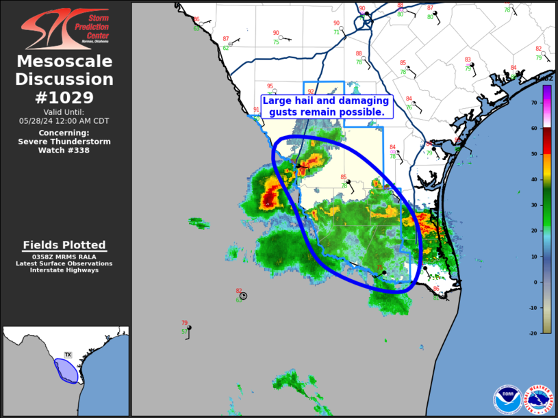
Mesoscale Discussion 1029 NWS Storm Prediction Center Norman OK 1100 PM CDT Mon May 27 2024 Areas affected...Middle/Lower Rio Grande Valley...South Central Texas Concerning...Severe Thunderstorm Watch 338... Valid 280400Z - 280500Z The severe weather threat for Severe Thunderstorm Watch 338 continues. SUMMARY...The threat for large hail and damaging gusts continues across the Middle Rio Grande Valley/south central Texas. DISCUSSION...Outflow-dominant thunderstorm that moved across deep south Texas has left rain-cooled air in its wake, with temperatures now generally in the 70s. This cooling and resultant convective inhibition will likely preclude the development of surface-based thunderstorm for the rest of the evening. However, ample mid-level moisture and steep mid-level lapse rates remain in place over the region, supportive of at least some potential for elevated thunderstorms. Isolated hail could occur with the strongest of these elevated storms. Farther north into Webb and Zapata Counties, an interesting convective evolution is underway with the storm just across the border surging eastward along the outflow from the storms farther south. Strong buoyancy and shear remains in place, and large hail and strong gusts will be possible with this storm for at least the next hour. Some in-situ development has also occurred near LRD amid strong low-level moisture convergence. Large hail and strong gusts are possible with this storm as well. ..Mosier.. 05/28/2024 ...Please see www.spc.noaa.gov for graphic product... ATTN...WFO...CRP...BRO... LAT...LON 27639982 27929959 27739864 26839776 25959791 26249906 27049953 27639982 |
|
|
Top/All Mesoscale Discussions/Forecast Products/Home |
|


