|
|
| Mesoscale Discussion 1020 | |
| < Previous MD Next MD > | |

|
|
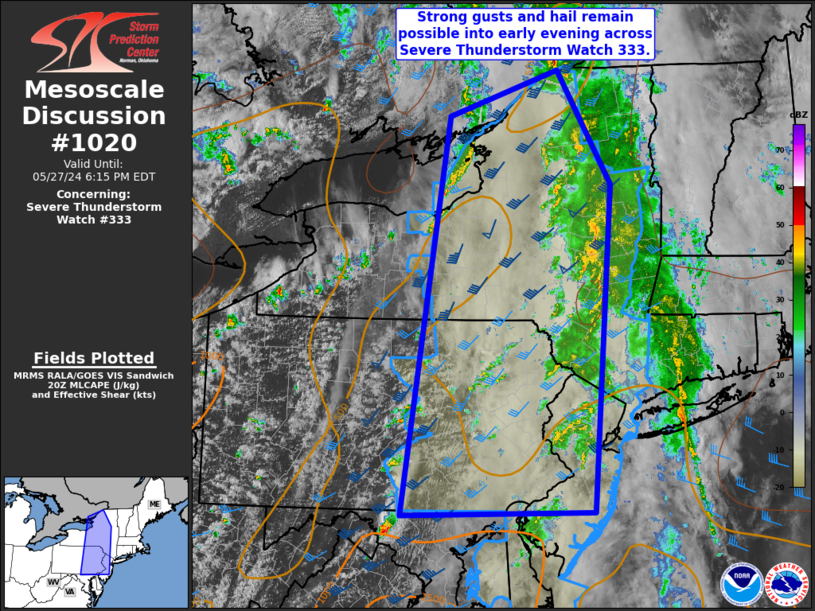
Mesoscale Discussion 1020 NWS Storm Prediction Center Norman OK 0340 PM CDT Mon May 27 2024 Areas affected...portions of NY...PA and NJ Concerning...Severe Thunderstorm Watch 333... Valid 272040Z - 272215Z The severe weather threat for Severe Thunderstorm Watch 333 continues. SUMMARY...Additional bands of thunderstorms are expected into early evening. Strong gusts and hail will be possible with these storms across Severe Thunderstorm Watch 333. DISCUSSION...Some clearing is evident across western portions of Severe Thunderstorm Watch 333, especially across central PA. Additional bands of thunderstorms are expected to develop as a cold front shifts east through evening. Surface dewpoints in the mid to upper 60s F are supporting modest instability amid moderate to strong deep-layer southwesterly flow. This should be sufficient for isolated severe thunderstorms producing gusts to near 60 mph. Any stronger cells also may produce small hail approaching 1 inch diameter. The severe risk should quickly diminish around sunset. ..Leitman.. 05/27/2024 ...Please see www.spc.noaa.gov for graphic product... ATTN...WFO...BTV...OKX...ALY...PHI...BGM...BUF...CTP...LWX... LAT...LON 44977493 43617407 39697437 39667742 44427669 44977493 |
|
|
Top/All Mesoscale Discussions/Forecast Products/Home |
|


