|
|
| Mesoscale Discussion 1013 | |
| < Previous MD | |

|
|
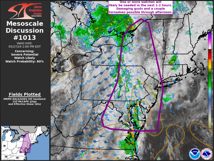
   Mesoscale Discussion 1013
   NWS Storm Prediction Center Norman OK
   1053 AM CDT Mon May 27 2024

   Areas affected...northern VA into parts of MD...DE...
   central/western PA...NJ...and NY

   Concerning...Severe potential...Watch likely

   Valid 271553Z - 271800Z

   Probability of Watch Issuance...80 percent

   SUMMARY...One or more watches will likely be needed in the next 1-2
   hours. Damaging gusts, large hail and a couple of tornadoes are
   possible with bands of thunderstorms through early evening.

   DISCUSSION...Modest destabilization is occurring from south to north
   ahead of an eastward-advancing front at midday. Stronger instability
   will generally remain across the PA/NJ vicinity southward, where
   dewpoints are in the upper 60s F, and decrease with northward extent
   into central NY. Nevertheless, favorable vertical shear supporting
   organized bands of convection is already in place across the region.
   A mixed mode of supercells and bows is expected as convection
   increases in coverage after 18z. While deep-layer flow will largely
   remain unidirectional, some curvature of low-level hodographs and
   backed low-level winds is evident in a corridor from eastern VA into
   eastern PA/western NJ. A couple of tornadoes could occur in this
   area. Otherwise, damaging gusts and hail will be the primary hazard
   through this afternoon/early evening. One or more watches will
   likely be needed in the next couple of hours as stronger
   destabilization occurs and stronger large-scale ascent overspreads
   the region.

   ..Leitman/Guyer.. 05/27/2024

   ...Please see www.spc.noaa.gov for graphic product...

   ATTN...WFO...BTV...OKX...ALY...PHI...BGM...AKQ...BUF...CTP...
   LWX...

   LAT...LON   45057540 44787471 42487405 40527353 37787411 37767592
               37877795 38037854 38547872 40997745 43887704 44547643
               45057540
|
|
|
Top/All Mesoscale Discussions/Forecast Products/Home |
|


