| Mesoscale Discussion 1003 | |
| < Previous MD | |

|
|
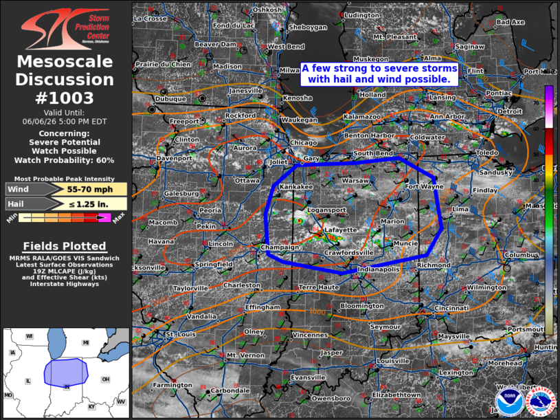
   Mesoscale Discussion 1003
   NWS Storm Prediction Center Norman OK
   0206 PM CDT Sat Jun 06 2026

   Areas affected...portions of eastern Illinois...northern
   Indiana...eastern Ohio

   Concerning...Severe potential...Watch possible

   Valid 061906Z - 062100Z

   Probability of Watch Issuance...60 percent

   SUMMARY...A few strong to severe storms possible this afternoon with
   potential for instances of large hail and strong to severe winds.

   DISCUSSION...Scattered thunderstorms have developed across northern
   Indiana/eastern Illinois this afternoon in the wake of morning
   convection south of the cold front near remnant outflow. While
   stronger flow aloft is shifting eastward, the air mass remains
   favorably unstable, with MLCAPE around 1000-2000 J/kg. In addition,
   shear profiles are sufficient to support potential for loosely
   organized multi-cells and transient supercell structures capable of
   severe hail.

   ..Thornton/Thompson.. 06/06/2026

   ...Please see www.spc.noaa.gov for graphic product...

   ATTN...WFO...ILN...IWX...IND...LOT...ILX...

   LAT...LON   40738813 41208796 41558745 41608617 41688521 41348447
               40508431 40078464 39778646 39958773 40088804 40738813

   MOST PROBABLE PEAK WIND GUST...55-70 MPH
   MOST PROBABLE PEAK HAIL SIZE...UP TO 1.25 IN
|
|
|
Top/All Mesoscale Discussions/Forecast Products/Home |
|
Source link