The 2025 Atlantic Hurricane Season officially begins June 1, and NOAA’s eyes in the sky are ready for whatever the season may bring.
Since the early days of the United States’ satellite program, Earth-observing satellites have played a vital role in detecting, monitoring and predicting tropical cyclones. In 1961, the TIROS III satellite became the first satellite to detect a tropical cyclone—Hurricane Esther—before any ship or reconnaissance aircraft first confirmed its existence. Decades later, NOAA’s current fleet of polar-orbiting satellites—the Joint Polar Satellite System Program (JPSS)—orbits the globe 14 times a day, providing detailed observations of our planet and its atmosphere.
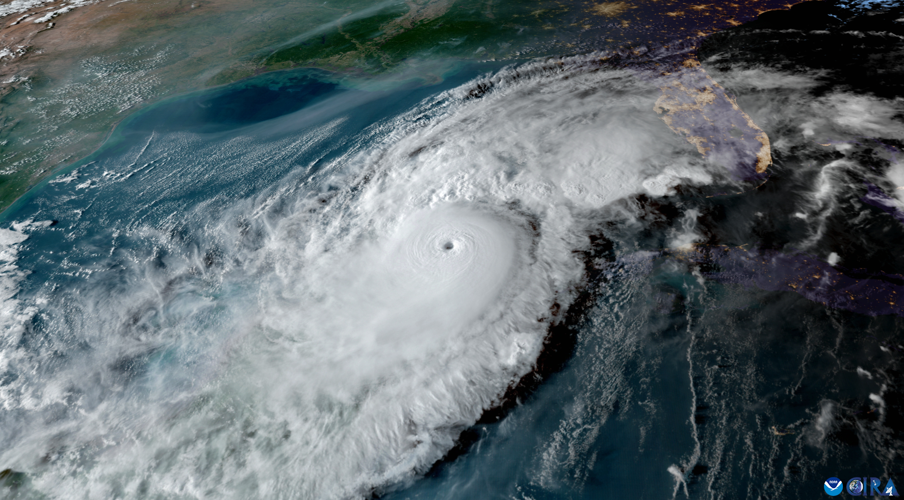
In 1975, NOAA’s Geostationary Operational Environmental Satellites (GOES) started a new revolution of satellites that observe and monitor tropical cyclones in near real-time. Today, as the GOES program celebrates its 50th anniversary, its latest generation of satellites, known as the GOES-R Series, continues that legacy of continuously observing the weather over much of the western Hemisphere, from New Zealand to the west coast of Africa.
“NOAA satellites are critical for monitoring the development, intensification and track of tropical storms and hurricanes each hurricane season,” said Dan Brown, Branch Chief of the Hurricane Specialist Unit within the National Weather Service (NWS), National Hurricane Center (NHC). “Imagery from these satellites help forecasters at the National Hurricane Center determine when a tropical depression or storm has formed and when the structure of the system may allow for rapid intensification. These data are crucial for warning the public of storm surge, wind and rainfall hazards associated with landfalling tropical storms and hurricanes.”
Before the Storm
Even when things are quiet, NOAA’s satellites are keeping an eye on the world’s weather. From monitoring the ocean looking for any signs of storm development to identifying areas where conditions are ripe for cyclones to form, these satellites are always providing forecasters with vital insights about the tropical environment.
Source link