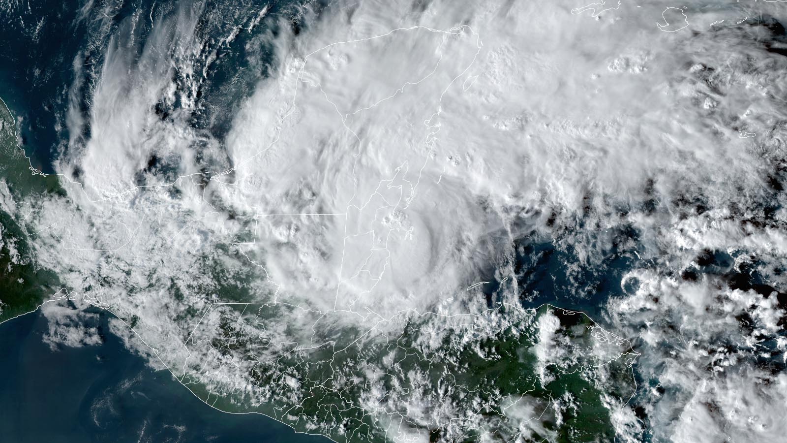
Hurricane Lisa made landfall at 5:20 p.m. EDT Wednesday, Nov. 2, about 10 miles southwest of Belize City, Belize. At landfall, Lisa was a category 1 storm with 85 mph winds and a central pressure of 990 mb. The hurricane passed directly over the capital of Belize, Belize City, where a large storm surge flooded much of the city.
At 11 a.m. EDT Thursday, Lisa was centered about 65 miles southeast of Ciudad del Carmen, Mexico, heading west at 10 mph, with top sustained winds of 35 mph and a central pressure of 1008 mb. Although just a tropical depression, Lisa appeared well-organized on satellite images and Mexican radar, with an area of heavy thunderstorms that were bringing heavy rains to southern Mexico and northwestern Guatemala. Lisa is predicted to bring 4-6 inches of rain to portions of Mexico along its track.
Forecast for Lisa
Lisa is expected to turn more to the northwest, on a track that will bring it over the Gulf of Mexico’s Bay of Campeche on Friday morning. Over the weekend, Lisa’s steering currents will collapse, and the system will meander slowly over the Bay of Campeche. High wind shear of 20-30 knots and dry air with a midlevel relative humidity of 45-50% are expected over the Gulf this weekend, and these hostile conditions will likely reduce Lisa to a remnant low by Sunday.
Martin remains a hurricane far to the north in central Atlantic
Hurricane Martin has become the most northerly hurricane ever observed so late in the year in the Atlantic, maintaining hurricane strength to a latitude of 45.6°N at 11 a.m. EDT Thursday. At that time, Martin was located about 765 miles northwest of the Azores, heading northeast at 48 mph, with top sustained winds of 85 mph and a central pressure of 960 mb. According to the NOAA historical hurricane database, the previous most northerly hurricane on record so late in the year was held by an unnamed 1891 hurricane, which maintained hurricane strength to a latitude of 45.12°N on November 6. Unusually warm waters more than 2 degrees Celsius (3.6°F) above average helped Martin remain a hurricane so far to the north.
Martin’s life as a hurricane was about to end early Thursday afternoon, though, as the hurricane was over waters of just 15 degrees Celsius (59°F). These cold waters, combined with the presence of a strong cold front, are causing Martin to transition to a hurricane-strength extratropical storm. Martin is not a threat to any land areas, but its strong winds cover a vast area of the northern Atlantic, and this wind field will create large waves that will impact portions of Atlantic Canada, the Azores, and the Atlantic coast of Europe over the next few days.
The ascension of Lisa and Martin to hurricane status brings this season’s activity to 13 named storms, seven hurricanes, and two major hurricanes, with an Accumulated Cyclone Energy (ACE) index 78% of average for the date. The 1991-2020 averages for Nov. 3 are 13.5 named storms, 6.7 hurricanes, and 3.1 major hurricanes, so 2022 is now near-average for the number of named storms and hurricanes, but below average for ACE and major hurricanes.
New tropical disturbance likely to soak the Southeast U.S. next week
A large and very unusual low-pressure system is forecast to form early next week, as the counterclockwise flow around a sprawling low near the Bahamas is predicted to cause the trade winds over much of the central Caribbean to reverse from their usual easterly direction to blow out of the west. This nontropical low may acquire some tropical or subtropical characteristics early next week as it wobbles to the northwest toward the Southeast U.S. coast. The low is likely to bring a multiday period of strong onshore flow and intermittent heavy rains to much of the coast from Florida to North Carolina, Monday through Friday. The large size of the low, combined with marginal upper-level winds and temperatures, should make any development of the system slow to occur. In its 8 a.m. EDT Friday Tropical Weather Outlook, the National Hurricane Center gave the system 2-day and 5-day odds of development of 0% and 30%, respectively.
Bob Henson contributed to this post.
Website visitors can comment on “Eye on the Storm” posts (see comments policy below). Sign up to receive notices of new postings here.
Source link