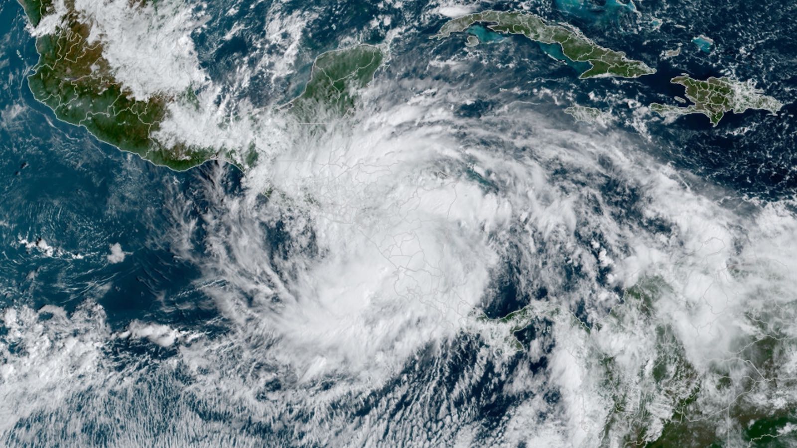
Tropical Storm Julia was drenching large parts of Central America on Sunday after crashing ashore near Laguna de Perlas, Nicaragua at 3:15 a.m. EDT as a category 1 hurricane with top sustained winds of 85 mph. Heading westward at a steady clip of 15 mph, Julia is expected to emerge into the Pacific late Sunday and carve its way into the record books as an unusual Atlantic-to-Pacific crossover: a system that maintains its identity as a tropical cyclone while crossing Central America.
Julia became a hurricane less than nine hours before landfall – which is fortunate. It had organized dramatically on Saturday night and could easily have become a category 2 or 3 storm with just a few more hours over the warm waters of the western Caribbean.
Julia passed just south of the Colombian island of San Andrés around 7 p.m. EDT Saturday, likely putting the island in its stronger (northern) eyewall. Colombian President Gustavo Petro tweeted on Sunday morning that there were two injuries, two homes destroyed, and 101 damaged on San Andrés.
Bluefields International Airport recorded sustained winds of 70 knots at 4 a.m. EDT, just after Julia’s landfall. Notably, these winds were observed in the south (weaker) side of Julia’s eyewall, suggesting even stronger winds may have affected the area in and just north of Laguna de Perlas, where photos and videos showed structural damage and trees down.
Flooding the main threat from Julia
Julia was pushing a very moist airmass onshore into rugged terrain, and its resulting torrential rains likely will produce dangerous flash floods and mudslides. The heaviest rains are expected in Nicaragua and El Salvador, where totals of 5-10 inches will be widespread, with isolated amounts of 15 inches are possible.
Easterly flow north of Julia’s circulation will bring additional heavy rain into areas well north of the storm, including Belize, Guatemala, and Honduras. Some rains will be welcome in parts of Central America that have been struggling with drought in recent months. However, the arrival of heavy rains in northwestern Honduras will be unwelcome: The region is dealing with flooding as a result of heavy rains that hit during the last week of September. That flooding on the Ulúa River in the Sula Valley killed 12 people and led to evacuations of 16,000 people. Saturated soils in the region will lead to more flooding if rains of consequence fall from Julia.


Julia will pass roughly 20-30 miles north of the capital of Managua, setting up the city’s closest approach from a tropical storm since Joan (1988) and Cesar (1996). Joan was much larger and stronger than Julia: making landfall at category 4 strength, Joan took more than 200 lives and caused almost $2 billion (USD 1988) in damage, mainly from severe flooding in Nicaragua and Colombia. Cesar made landfall as a minimal category 1 storm (later becoming a category 4 storm in the Pacific), inflicting more than $200 million in damage, mainly to Costa Rica, and leading to more than 100 deaths.
Julia may become the second Atlantic-to-Pacific crossover of 2022
Both Joan and Cesar were among the select group of systems known as Atlantic-Pacific crossovers, as they maintained their status as a tropical cyclone throughout their westward treks across Central America. Such systems have occurred roughly every 5 to 10 years during the satellite era, but there were two crossovers each in 1988 (Debby and Joan) and 1996 (Cesar and Dolly).
During the 20th century, crossovers were assigned new names if they were at least tropical storm strength in the Pacific. For example, in 1988, Joan became Miriam in the Pacific, and in 1996, Cesar became Douglas. That practice was changed by the World Meteorological Organization in 2000, so that a crossover now keeps its original Atlantic name in the Pacific if it was classified as a tropical cyclone when it emerged there. That is what happened with Otto (2016) and Bonnie (2022).
Julia is projected to remain a tropical storm as it moves over or just south of the Pacific coast of El Salvador into Monday. Interaction with land and with a broad area of low pressure to its west are expected to lead to gradual weakening into a tropical depression by later Monday. Although dissipation is likely after that point, ensemble models suggest that Julia or its remnants could hang on as an identifiable feature through much of the week while continuing west, most likely staying just south of Guatemala and Mexico.
Jeff Masters contributed to this post. Website visitors can comment on “Eye on the Storm” posts (see comments policy below). Sign up to receive notices of new postings here.
Source link