

| Mesoscale Discussion 2456 | |
| < Previous MD | |

|
|
   Mesoscale Discussion 2456
   NWS Storm Prediction Center Norman OK
   1253 AM CST Wed Nov 18 2026

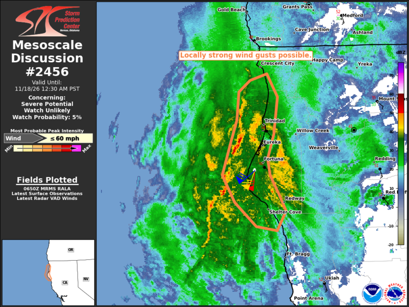
   Areas affected...Northern California Coast

   Concerning...Severe potential...Watch unlikely

   Valid 180653Z - 180830Z

   Probability of Watch Issuance...5 percent

   SUMMARY...The potential for a few strong wind gusts will exist with
   deeper convective elements moving onshore through 08Z.

   DISCUSSION...Radar observations from Eureka, CA (KBHX), indicate a
   narrow convective band with sporadic lightning embedded within a
   broader stratiform region of precipitation approaching the coast as
   of 0645Z. The associated VWP data indicate the presence of a very
   strong wind field preceding the convection with 65+ kt southerly
   winds in the lowest km AGL. And while instability remains quite weak
   (i.e., MUCAPE less than 200-300 J/kg), the potential exists for a
   few strong surface wind gusts owing to downdraft-aided turbulent
   mixing associated with any deeper convective elements moving
   onshore. The threat should remain confined to the immediate coast
   where the marine influence is supporting the weak buoyancy.

   ..Mead/Guyer.. 11/18/2026

   ...Please see www.spc.noaa.gov for graphic product...

   ATTN...WFO...EKA...

   LAT...LON   41102456 41442453 41592435 41662409 41382391 40932397
               40632407 40432404 40182389 40012378 39772393 39812426
               40112460 40442479 40852465 41102456

   MOST PROBABLE PEAK WIND GUST...UP TO 60 MPH
|
|
|
Top/All Mesoscale Discussions/Forecast Products/Home |
|
Source link