

| Mesoscale Discussion 2432 | |
| < Previous MD Next MD > | |

|
|
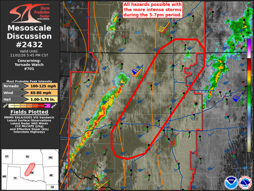
Mesoscale Discussion 2432 NWS Storm Prediction Center Norman OK 0342 PM CST Mon Nov 02 2026 Areas affected...central into northern OK...far southern KS Concerning...Tornado Watch 701... Valid 022142Z - 022345Z The severe weather threat for Tornado Watch 701 continues. SUMMARY...All severe hazards are possible with the stronger storms as they continue to intensify during the 5-7pm period. DISCUSSION...A band of intensifying thunderstorms over western OK will continue moving to the northeast into central and northern OK and adjacent parts of southern KS during the next several hours. A residual stratus field is gradually eroding ahead of the thunderstorm activity where temperatures are warming into the lower to mid 70s deg F. Surface dewpoints range 65-68 deg F. Ample veering and strengthening of flow with height (i.e., KTLX VAD) will support organized linear bands. The potential for a few supercells ---contingent on stronger updrafts developing--- not experiencing destructive interference or hybrid mesocyclonic/mesovortex structures will seemingly increase through the early evening. The sizable low-level hodographs will support both a risk for a few tornadoes and severe gusts. ..Smith.. 11/02/2026 ...Please see www.spc.noaa.gov for graphic product... ATTN...WFO...TSA...ICT...OUN... LAT...LON 37079769 37299729 37289672 37079652 36719655 34919806 34799850 34859879 35049890 35349892 37079769 MOST PROBABLE PEAK TORNADO INTENSITY...100-125 MPH MOST PROBABLE PEAK WIND GUST...65-80 MPH MOST PROBABLE PEAK HAIL SIZE...1.00-1.75 IN |
|
|
Top/All Mesoscale Discussions/Forecast Products/Home |
|
Source link