

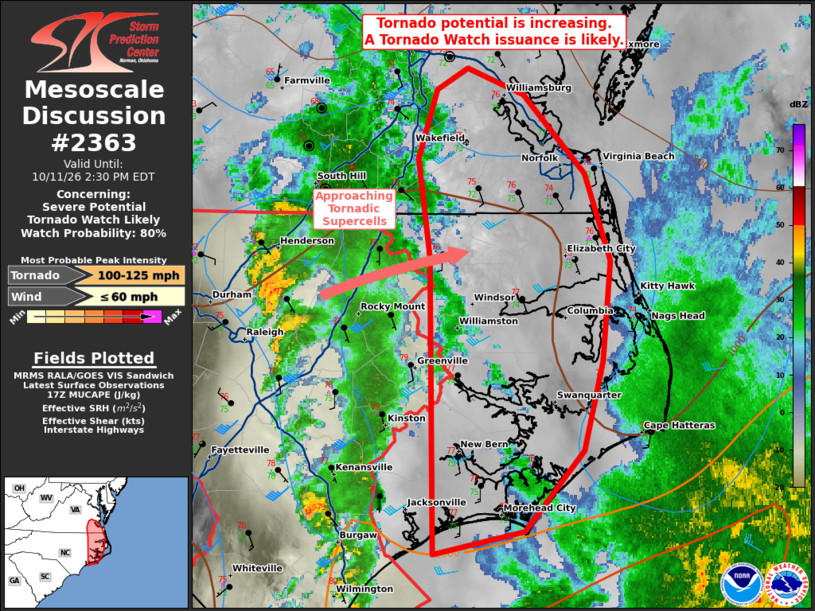
| Mesoscale Discussion 2363 | |
| < Previous MD | |

|
|
   Mesoscale Discussion 2363
   NWS Storm Prediction Center Norman OK
   1235 PM CDT Sun Oct 11 2026

   Areas affected...portions of southeast Virginia into eastern North
   Carolina

   Concerning...Severe potential...Tornado Watch likely

   Valid 111735Z - 111830Z

   Probability of Watch Issuance...80 percent

   SUMMARY...The tornado threat is expected to increase across portions
   of southeastern Virginia into eastern North Carolina. A Tornado
   Watch issuance is likely.

   DISCUSSION...A pair of tornadic supercells across northern NC are
   poised to track eastward as an axis of coinciding strong low-level
   shear and low to moderate CAPE continues to advance with a surface
   low. Earlier precipitation has cleared this region, with surface
   temperatures already climbing to 78 F in spots, with low to mid 70s
   F surface dewpoints noted. With time, low-level shear will only
   continue to increase, along with the threat for at least a few
   additional tornadoes wherever supercell structures manifest.

   ..Squitieri/Smith.. 10/11/2026

   ...Please see www.spc.noaa.gov for graphic product...

   ATTN...WFO...AKQ...MHX...RAH...

   LAT...LON   34487722 36277726 36877734 37297721 37427698 37277656
               36797609 36257590 35647596 35117610 34617654 34487722

   MOST PROBABLE PEAK TORNADO INTENSITY...100-125 MPH
   MOST PROBABLE PEAK WIND GUST...UP TO 60 MPH
|
|
|
Top/All Mesoscale Discussions/Forecast Products/Home |
|
Source link