

| Mesoscale Discussion 2362 | |
| < Previous MD | |

|
|
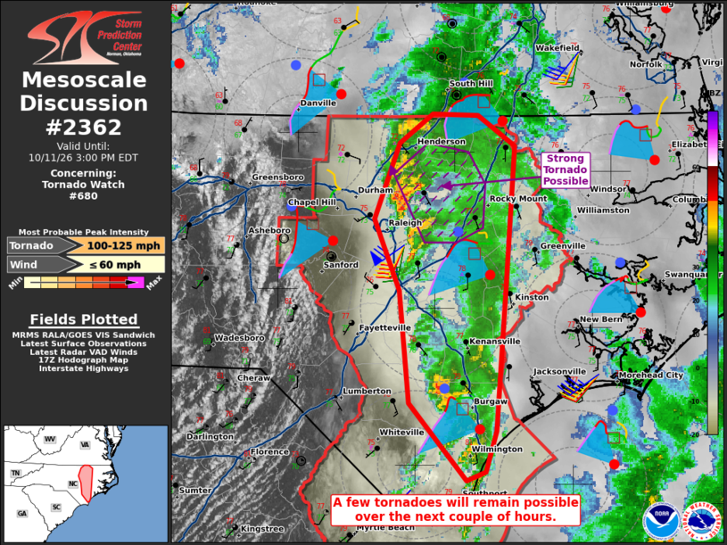
Mesoscale Discussion 2362 NWS Storm Prediction Center Norman OK 1225 PM CDT Sun Oct 11 2026 Areas affected...portions of central into northern North Carolina Concerning...Tornado Watch 680... Valid 111725Z - 111900Z The severe weather threat for Tornado Watch 680 continues. SUMMARY...A few more tornadoes are possible across portions of central into northern NC. The supercells over northern NC have the best chance at producing a strong tornado. DISCUSSION...Supercells continue along a confluence band over central into northern NC, with radar-indicated tornadoes ongoing with the northern NC storms. Regional VADs continue to show curved hodographs and over 200 m2/s2 of 0-500 m SRH, supporting tornado potential. Relatively well-organized supercells are ongoing just north of Raleigh NC, ahead of the surface low, where surface flow is most backed. Given the well-organized supercell structures and strong SRH, an EF2 equivalent intensity tornado is possible with the northern NC storms. ..Squitieri.. 10/11/2026 ...Please see www.spc.noaa.gov for graphic product... ATTN...WFO...AKQ...MHX...RAH...ILM... LAT...LON 35837873 36367853 36567824 36557786 36347756 35347764 34387772 34117780 34057796 34587844 35347853 35837873 MOST PROBABLE PEAK TORNADO INTENSITY...100-125 MPH MOST PROBABLE PEAK WIND GUST...UP TO 60 MPH |
|
|
Top/All Mesoscale Discussions/Forecast Products/Home |
|
Source link